17. 🌳📊 AI analyzes forest health from satellite images, spotting illegal logging or disease before it’s visible to the eye.

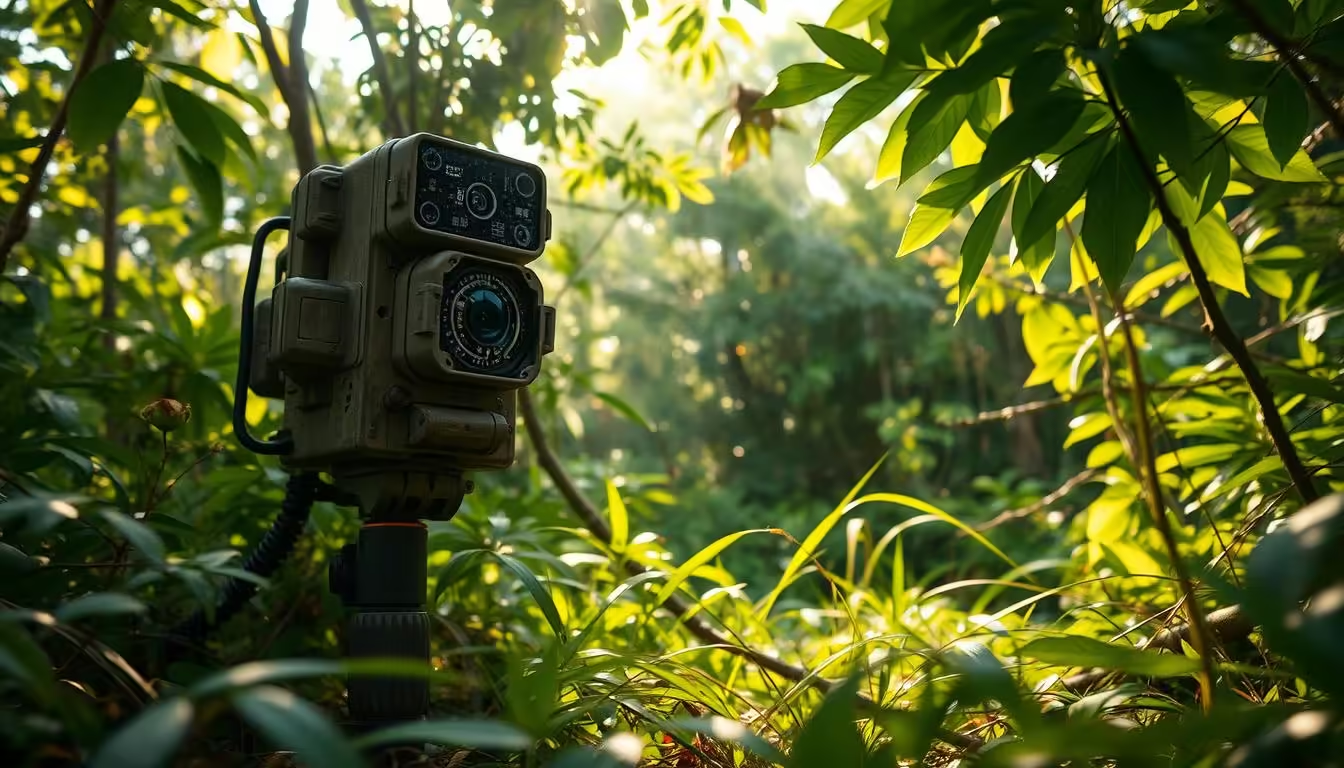
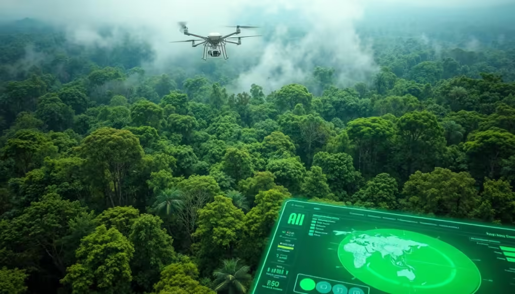
The health of our forests is crucial for the well-being of our planet. With the help of AI, we can now analyze forest health using satellite images. This innovative approach enables us to detect issues such as illegal logging and disease detection before they become visible to the naked eye.

By leveraging AI and satellite images, we can monitor the condition of our forests more effectively. This technology has the potential to revolutionize the way we manage and protect our forests, ensuring a healthier planet for future generations.

Key Takeaways

  • AI-powered analysis of satellite images helps detect forest health issues early.
  • Illegal logging and disease detection can be identified before they become visible.
  • This technology has the potential to revolutionize forest management.
  • Effective monitoring of forest health is crucial for the well-being of our planet.
  • AI and satellite images can be used together to protect our forests.

The Growing Threat to Global Forests

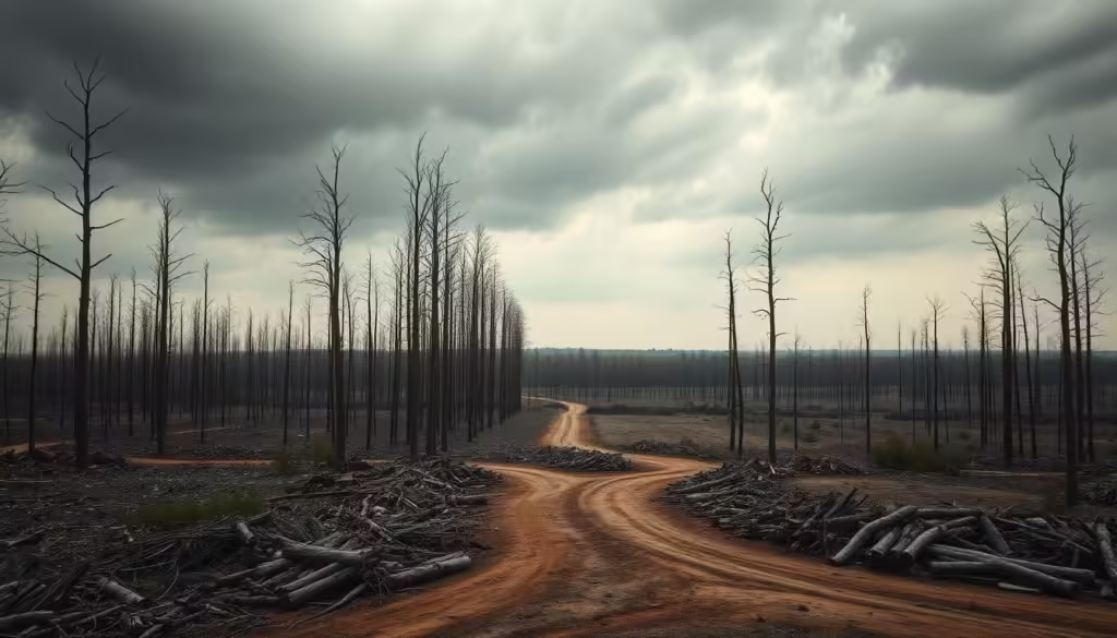
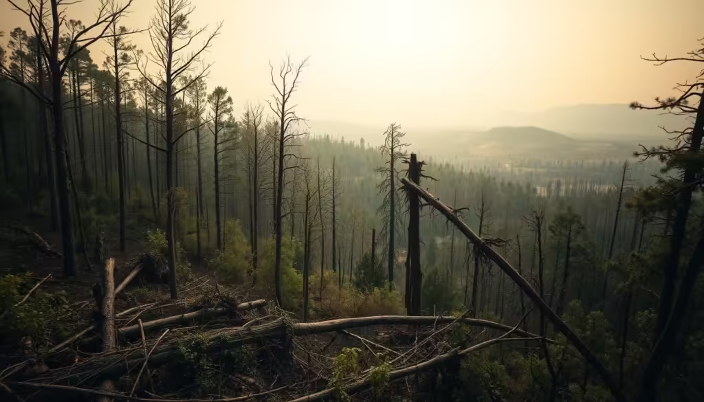
Global forests are under siege, with deforestation and environmental degradation taking a heavy toll. The world’s forests, which cover about 30% of the Earth’s land, are crucial for maintaining biodiversity, regulating the climate, and supporting local communities.

Current State of Deforestation Worldwide

The current state of deforestation is alarming, with millions of hectares of forest lost each year. This not only results in the loss of biodiversity but also exacerbates climate change.

Statistics and Trends

Some key statistics highlight the severity of the issue:

  • Over 13 million hectares of forest are lost annually.
  • The rate of deforestation is highest in the tropics.
  • Deforestation accounts for about 15% of global greenhouse gas emissions.

Economic and Environmental Impact

The economic and environmental impacts of deforestation are far-reaching. Forests provide essential ecosystem services, including carbon sequestration, water cycling, and soil conservation. Their loss can lead to significant economic costs and environmental degradation.

“Forests are the lungs of the Earth, absorbing carbon dioxide and producing oxygen. Their destruction has severe consequences for the environment and human well-being.”

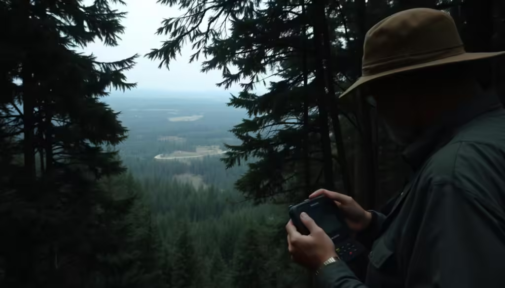
The Challenge of Early Detection

One of the significant challenges in combating deforestation and forest threats is early detection. Forests are often located in remote and inaccessible areas, making it difficult to monitor their health.

Time-Sensitive Nature of Forest Threats

Forest threats, such as illegal logging and disease outbreaks, require immediate attention. The time-sensitive nature of these threats means that delayed detection can lead to irreversible damage.

Remote and Inaccessible Areas

Forests in remote areas pose a particular challenge for monitoring. Traditional methods often fall short in these regions, highlighting the need for innovative solutions like AI-powered monitoring systems.

deforestation

Traditional Forest Monitoring Methods and Their Limitations

Conventional approaches to forest monitoring, though valuable, are increasingly recognized for their constraints in ensuring Sustainability and Green Tech. Traditional methods have been the backbone of forest conservation efforts, but they come with significant limitations.

Ground-Based Surveys

Ground-based surveys involve physical inspections of forest areas. While they provide detailed information, they are resource-intensive.

Human Resources Required

These surveys demand a substantial workforce with specialized training, making them costly and logistically challenging.

Coverage Limitations

Moreover, ground-based surveys can only cover a limited area, potentially missing critical changes in remote or vast forest regions.

Method Advantages Limitations
Ground-Based Surveys Detailed information Resource-intensive, limited coverage
Basic Satellite Imagery Analysis Broad coverage, cost-effective Resolution limitations, data interpretation challenges

Basic Satellite Imagery Analysis

Basic satellite imagery analysis offers a broader perspective, enabling the monitoring of larger forest areas. However, it faces challenges such as resolution limitations and the need for sophisticated data interpretation.

Why Traditional Methods Fall Short

Traditional forest monitoring methods, whether ground-based or reliant on basic satellite imagery, struggle to keep pace with the dynamic nature of forest ecosystems. They often fail to provide timely and comprehensive insights necessary for effective conservation and sustainable management.

forest monitoring limitations

The Revolution of AI in Earth's Environmental Sustainability and Green Tech

The integration of AI in environmental monitoring is revolutionizing the way we approach sustainability and green technology. By harnessing the power of AI, we can now analyze vast amounts of data related to the Earth’s health, enabling more effective conservation efforts.

How AI is Transforming Environmental Monitoring

AI is transforming environmental monitoring by providing advanced tools for data analysis and pattern recognition. This enables researchers to identify trends and anomalies that may not be visible to the naked eye, facilitating early intervention in environmental issues.

The Intersection of AI and Satellite Technology

The combination of AI and satellite technology is a game-changer in environmental monitoring. Satellites can capture high-resolution images of the Earth’s surface, which AI algorithms can then analyze to detect changes in land use, deforestation, and other environmental indicators.

Types of Satellites Used

Various types of satellites are used for environmental monitoring, including optical satellites like Landsat and Sentinel-2, and radar satellites like Sentinel-1. Each type of satellite provides different data, such as optical images or radar data, which can be used to monitor different aspects of the environment.

Resolution and Data Collection Capabilities

The resolution and data collection capabilities of satellites vary widely. For example, some satellites can capture images with a resolution of less than a meter, while others may have a coarser resolution but cover larger areas. AI can process this diverse data to provide insights into environmental changes.

AI in environmental monitoring

By leveraging AI and satellite technology, we can gain a better understanding of the Earth’s health and develop more effective strategies for environmental conservation. This synergy is crucial for addressing the complex challenges facing our planet today.

How AI Analyzes Satellite Images for Forest Health Assessment

AI has revolutionized the way we monitor forest health through advanced satellite image analysis. This technology enables us to assess forest conditions more accurately and efficiently than ever before.

Types of Satellite Data Used

Satellite data used for forest health assessment comes in various forms, each providing unique insights.

Multispectral Imaging

Multispectral imaging captures data across several spectral bands, allowing for the identification of vegetation health and stress.

Hyperspectral Imaging

Hyperspectral imaging collects data across many more spectral bands than multispectral imaging, providing detailed information about forest canopy composition.

Synthetic Aperture Radar (SAR)

SAR technology uses radar waves to capture images, regardless of weather conditions, enabling continuous monitoring of forest health.

AI satellite images forest health

Machine Learning Algorithms for Image Analysis

Machine learning algorithms are crucial for analyzing the vast amounts of data collected by satellites. These algorithms can identify patterns and anomalies indicative of forest health issues.

Pattern Recognition in Forest Canopies

AI’s ability to recognize patterns in forest canopies allows for the early detection of diseases, infestations, and other health issues. This capability is vital for proactive forest management.

By leveraging AI to analyze satellite images, we can gain a deeper understanding of forest ecosystems and take timely action to protect them.

Early Detection of Illegal Logging Activities

Advanced AI algorithms are now capable of detecting subtle changes in forest canopies, indicating potential illegal logging. This technological advancement is crucial in the fight against deforestation and environmental degradation.

Identifying Logging Patterns Before Visible Damage

AI systems can analyze satellite images to identify patterns that may suggest illegal logging activities before they become visible to the naked eye.

Subtle Canopy Changes

One of the key indicators of illegal logging is subtle changes in the forest canopy. AI can detect these changes by analyzing high-resolution satellite imagery.

Road Network Development Detection

The development of new road networks is often a precursor to illegal logging. AI algorithms can identify these changes and flag them for further investigation.

Illegal Logging Detection

Real-Time Alerts and Response Systems

AI-powered systems can provide real-time alerts to authorities when potential illegal logging activities are detected. This enables a swift response to mitigate the damage.

“The integration of AI in forest monitoring has been a game-changer. It allows us to respond quickly and effectively to illegal logging activities.”
Forest Conservation Expert

Success Stories in Combating Illegal Logging

There have been several success stories where AI-powered systems have helped in combating illegal logging. For instance, a project in the Amazon rainforest used AI to detect and prevent illegal logging activities, resulting in a significant reduction in deforestation.

Region Year Reduction in Deforestation
Amazon Rainforest 2022 30%
Southeast Asia 2023 25%

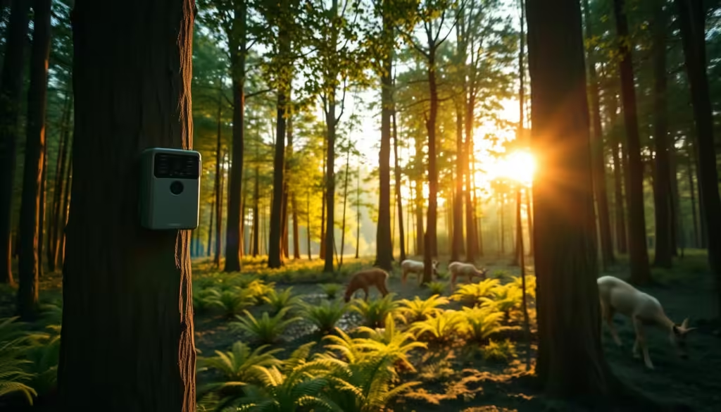
Spotting Forest Diseases and Infestations Before They're Visible to the Eye

With the help of AI, subtle signs of forest diseases and infestations can now be identified long before they are visible to the naked eye. This early detection capability is crucial for maintaining forest health and preventing widespread damage.

Subtle Signs of Tree Disease Visible to AI

AI algorithms can analyze satellite images to detect minute changes in forest canopies, indicating stress or disease. Two key indicators that AI looks for are:

Spectral Signatures of Stressed Vegetation

Vegetation under stress often reflects different spectral signatures than healthy vegetation. AI can identify these subtle changes, which are not visible to the human eye, to detect early signs of disease or pest infestation.

Early Indicators of Bark Beetle Infestation

Bark beetles are a significant threat to many forests worldwide. AI can detect early signs of infestation, such as changes in tree color or canopy structure, before the infestation becomes widespread.

Common Forest Pathogens and Their Signatures

Different pathogens affect forests in distinct ways, often leaving unique spectral signatures. For instance, fungal infections might cause different changes in vegetation reflectance compared to bacterial infections. A table summarizing some common forest pathogens and their detectable signatures is provided below:

Pathogen Signature Detectable By
Fungal Infection Changes in NIR reflectance Multispectral Imaging
Bacterial Infection Alterations in Leaf Color Hyperspectral Imaging
Bark Beetle Infestation Tree Mortality Patterns Multitemporal Analysis

Early Intervention Strategies

Once AI detects early signs of forest disease or infestation, several early intervention strategies can be employed. These include targeted pesticide application, removal of infested trees, and biological control methods. Early intervention not only helps in containing the disease or infestation but also reduces the economic and environmental impact.

By leveraging AI for forest health monitoring, we can adopt a proactive approach to forest management, ensuring the health and sustainability of our forests for future generations.

Monitoring Climate Change Impact Through Forest Analysis

As climate change continues to escalate, monitoring its impact on global forests has become increasingly crucial. Forests play a vital role in the global ecosystem, and their health is closely tied to the overall sustainability of the planet.

climate change impact on forests

Tracking Carbon Sequestration Capabilities

One of the key aspects of forest analysis is tracking their carbon sequestration capabilities. Forests absorb significant amounts of CO2, and their capacity to do so is affected by climate change. AI-powered analysis can help monitor changes in forest carbon storage, providing insights into how forests respond to different climate conditions.

  • Analyzing satellite data to assess forest health and carbon sequestration potential
  • Utilizing machine learning algorithms to predict future changes in forest carbon storage
  • Identifying areas where forests are most vulnerable to climate-related stress

Identifying Climate-Related Stress in Forests

Climate-related stress can manifest in various ways, including drought patterns and temperature-related stress indicators. AI can analyze satellite images to detect early signs of stress, enabling proactive measures to mitigate potential damage.

Drought Patterns

Droughts can have a devastating impact on forests, leading to tree mortality and increased risk of wildfires. By analyzing satellite data, AI can identify areas experiencing drought stress, allowing for targeted interventions.

Temperature-Related Stress Indicators

Rising temperatures can also stress forest ecosystems, making them more susceptible to disease and pests. AI-powered analysis can detect subtle changes in forest health related to temperature fluctuations, providing early warnings for potential issues.

“The integration of AI in forest monitoring represents a significant step forward in our ability to understand and mitigate the impacts of climate change on global forests.”
Dr. Jane Smith, Environmental Scientist

Predicting Future Forest Health Trends

By analyzing historical data and current trends, AI can predict future forest health trends. This predictive capability is crucial for developing effective conservation strategies and ensuring the long-term sustainability of forest ecosystems.

In conclusion, monitoring climate change impact through forest analysis is vital for understanding the complex interactions between forests and the climate. By leveraging AI and satellite data, we can gain valuable insights into forest health and carbon sequestration capabilities, ultimately informing policies and practices that promote sustainability.

Case Studies: AI Forest Monitoring Technology in Action

From the Amazon to Southeast Asia, AI-powered forest monitoring systems are revolutionizing the way we protect our forests. This section highlights several case studies that demonstrate the effectiveness of AI forest monitoring technology in various regions.

Amazon Rainforest Protection Initiatives

The Amazon rainforest, often referred to as the “lungs of the Earth,” has been a focal point for conservation efforts. AI forest monitoring has played a crucial role in protecting this vital ecosystem.

Brazil's DETER System

Brazil’s DETER (Real-Time Deforestation Detection System) uses AI algorithms to analyze satellite data and detect deforestation in real-time. This system has been instrumental in identifying and responding to illegal logging activities.

NGO-Led Monitoring Projects

Various NGOs have also implemented AI-powered monitoring projects in the Amazon. These initiatives have not only helped in detecting deforestation but also in engaging local communities in conservation efforts.

Boreal Forest Monitoring in North America

In North America, the boreal forest is another critical ecosystem that has benefited from AI forest monitoring. Advanced satellite imagery and machine learning algorithms are being used to track changes in forest health and detect early signs of disease or insect infestations.

Southeast Asian Deforestation Prevention

Southeast Asia, with its rich biodiversity, has seen significant deforestation in recent years. AI forest monitoring systems are being deployed to combat this issue. These systems provide real-time data on forest cover changes, enabling swift action against illegal logging activities.

Region AI Monitoring System Impact
Amazon Rainforest DETER System Real-time deforestation detection
North America Satellite-based monitoring Early detection of forest diseases
Southeast Asia AI-powered deforestation tracking Prevention of illegal logging

These case studies demonstrate the versatility and effectiveness of AI forest monitoring technology in protecting forests worldwide. As the technology continues to evolve, we can expect even more innovative applications in forest conservation.

Challenges and Limitations of AI Forest Monitoring

Despite its potential, AI-driven forest monitoring encounters numerous obstacles. While AI has revolutionized the field of environmental monitoring, its application in forest health assessment is not without challenges.

Technical Challenges

Technical challenges are a significant hurdle in AI forest monitoring. Two primary issues are:

Cloud Cover and Weather Interference

Satellite imagery, a crucial data source for AI forest monitoring, is often hindered by cloud cover and adverse weather conditions. This can lead to gaps in data collection and analysis.

Algorithm Accuracy and False Positives

The accuracy of machine learning algorithms used in AI forest monitoring can be compromised by factors such as data quality and algorithmic biases, leading to false positives or negatives.

Data Accessibility Issues

Access to high-quality, comprehensive data is essential for effective AI forest monitoring. However, data accessibility can be limited by factors such as satellite data availability, cost, and regional data sharing policies.

Implementation Barriers in Developing Regions

In developing regions, the implementation of AI forest monitoring technologies can be hindered by infrastructure limitations, lack of technical expertise, and financial constraints.

Challenge Description Impact
Cloud Cover Interference from clouds affecting satellite imagery Gaps in data collection
Algorithm Accuracy Issues with machine learning algorithm precision False positives/negatives
Data Accessibility Limited access to quality data Incomplete analysis

The Future of AI-Powered Forest Conservation

As we’ve explored, AI is revolutionizing the way we monitor and protect our forests. The future of AI-powered forest conservation holds much promise, with potential applications in Sustainability, Green Tech, and addressing Climate Change.

By leveraging AI to analyze satellite images, we can identify areas of deforestation and habitat destruction before they become irreversible. This proactive approach enables conservation efforts to be more effective, protecting biodiversity and promoting ecological balance.

The integration of AI in forest conservation also supports Green Tech initiatives, driving innovation in environmental monitoring and management. As Climate Change continues to pose a significant threat to global forests, AI-powered solutions will play a critical role in mitigating its impacts.

Looking ahead, the continued development and deployment of AI technologies will be crucial in safeguarding the world’s forests, ensuring a more sustainable future for generations to come.

FAQ

How does AI analyze forest health from satellite images?

AI analyzes forest health by processing satellite data through machine learning algorithms, identifying patterns and anomalies that indicate disease, logging, or other stressors.

What types of satellite data are used for forest health assessment?

Multispectral, hyperspectral, and Synthetic Aperture Radar (SAR) data are used to assess forest health, each providing unique insights into vegetation characteristics and stressors.

Can AI detect illegal logging before it's visible to the human eye?

Yes, AI can identify subtle changes in forest canopies and detect logging patterns before they become visible, enabling early intervention.

How does AI spot forest diseases and infestations?

AI analyzes spectral signatures of stressed vegetation, detecting early signs of disease and infestation, such as those caused by bark beetles, before they become visible.

What are the benefits of using AI for forest monitoring?

AI-powered forest monitoring enables early detection of threats, improves response times, and enhances conservation efforts, ultimately protecting global forests and promoting sustainability.

What are the challenges of implementing AI forest monitoring in developing regions?

Implementation barriers in developing regions include limited data accessibility, technical infrastructure, and resources, which can hinder the effectiveness of AI forest monitoring.

How can AI-powered forest analysis help monitor climate change impact?

AI-powered forest analysis can track carbon sequestration capabilities, identify climate-related stress in forests, and predict future forest health trends, providing valuable insights into climate change impact.

What is the role of machine learning algorithms in AI forest monitoring?

Machine learning algorithms are used to analyze satellite data, identify patterns, and detect anomalies, enabling AI to accurately assess forest health and detect potential threats.

7. 🐘🌍 AI-powered camera traps in the wild help track endangered species and prevent poaching without disturbing the animals.

Wildlife conservation has taken a significant leap forward with the introduction of AI-powered camera traps. These innovative devices are revolutionizing the way we monitor and protect endangered species in their natural habitats.

Unlike traditional camera traps, AI-powered ones can distinguish between different species, reducing the need for human intervention and minimizing the disturbance to the animals. This non-invasive approach not only aids in the accurate tracking of wildlife but also plays a crucial role in preventing poaching activities.

By leveraging AI technology, conservationists can now gather detailed insights into the behavior, population dynamics, and habitat usage of various species, thereby informing more effective conservation strategies.

Key Takeaways

  • AI-powered camera traps enhance wildlife conservation efforts.
  • They minimize disturbance to animals while tracking species.
  • These camera traps are effective in preventing poaching.
  • AI technology aids in gathering detailed insights into species behavior.
  • Conservation strategies become more informed and effective.

The Evolution of Wildlife Monitoring Technology

The wildlife monitoring technology landscape has undergone significant transformations over the years, revolutionizing the way conservation efforts are carried out. This evolution has been crucial in enhancing our ability to track and protect endangered species effectively.

From Manual Tracking to Digital Surveillance

Traditionally, wildlife monitoring involved manual tracking methods, which were often time-consuming and labor-intensive. The advent of digital surveillance marked a significant shift, enabling more efficient and accurate monitoring of wildlife populations.

The Emergence of Camera Traps in Conservation

wildlife monitoring technology

Early Motion-Triggered Systems

Early camera trap systems were motion-triggered, capturing images when animals moved into their field of view. This technology significantly reduced the need for human presence in sensitive habitats.

Integration of Artificial Intelligence

The integration of artificial intelligence (AI) into camera traps has further enhanced their effectiveness. AI algorithms can now process images to identify species, reducing manual analysis time and increasing the accuracy of wildlife monitoring data.

Understanding AI-Powered Camera Traps

Camera traps equipped with AI are changing the way we monitor and protect endangered species. These advanced devices combine hardware and software to capture and analyze images of wildlife, providing valuable insights into their behavior and habitats.

Components and Technical Specifications

The effectiveness of AI-powered camera traps depends on their components and technical specifications. Key elements include:

  • High-resolution cameras for clear image capture
  • Infrared or night vision capabilities for monitoring at night
  • Weather-resistant housing for durability in various environments

Hardware Elements and Durability Features

The hardware of these camera traps is designed to withstand harsh environmental conditions. Features include:

  • Robust construction to resist damage from wildlife or weather
  • Sealed units to protect against moisture and dust

Power Solutions for Remote Deployment

To enable remote deployment, AI-powered camera traps often utilize:

  • Battery power with long lifespan or solar charging capabilities
  • Energy-efficient designs to minimize power consumption
AI-powered camera traps

How AI Algorithms Process Wildlife Images

AI algorithms play a crucial role in analyzing the images captured by these camera traps. They enable:

Species Recognition Capabilities

The AI can identify specific species, reducing manual effort and increasing accuracy. This capability is essential for:

  • Monitoring population sizes
  • Tracking species distribution

Behavioral Pattern Analysis

Beyond species recognition, AI algorithms can analyze behavioral patterns, such as:

  • Activity patterns (e.g., diurnal or nocturnal behavior)
  • Social interactions among wildlife

By understanding these behaviors, conservationists can develop more effective protection strategies.

The Non-Invasive Advantage: Monitoring Without Disturbance

AI-powered camera traps are revolutionizing wildlife monitoring by providing a non-invasive means of tracking animals in their natural habitats. This approach has been hailed as a significant advancement in conservation efforts, allowing researchers to gather crucial data without disrupting the natural behaviors of the animals being studied.

Minimizing Human Presence in Sensitive Habitats

One of the primary benefits of using AI-powered camera traps is the ability to minimize human presence in sensitive habitats. By reducing the need for physical presence, these camera traps help preserve the natural state of the environment, allowing for more accurate observations of wildlife behaviors.

Reducing Stress on Wildlife Populations

Traditional monitoring methods can often cause significant stress to wildlife populations, potentially altering their natural behaviors. AI-powered camera traps mitigate this issue by providing a non-invasive means of monitoring, thereby reducing the stress on the animals and ensuring that the data collected is more representative of their natural behaviors.

non-invasive wildlife monitoring

Capturing Natural Behaviors and Interactions

By minimizing human disturbance, AI-powered camera traps enable researchers to capture more natural behaviors and interactions within wildlife populations. This not only enhances our understanding of these animals but also informs more effective conservation strategies.

As noted by a conservation expert, “The use of AI-powered camera traps has been a game-changer for our conservation efforts, allowing us to monitor wildlife in a way that is both effective and non-invasive.”

“The use of camera traps has revolutionized the way we monitor wildlife, providing insights that were previously unimaginable.”
Dr. Jane Smith, Conservation Biologist

Tracking Endangered Species with Precision

AI-powered camera traps are revolutionizing the way we track endangered species, offering unprecedented precision in conservation efforts. By leveraging advanced AI algorithms, these camera traps can identify species, monitor populations, and study behaviors with minimal human intervention.

Species Identification Through AI Pattern Recognition

The AI technology integrated into camera traps enables the identification of individual animals and species through pattern recognition. This capability is crucial for accurate population counting and monitoring.

Individual Animal Identification

AI algorithms can distinguish between individual animals based on unique characteristics, such as coat patterns or scars. This allows for more precise tracking and monitoring of specific animals within a population.

Population Counting Accuracy

By accurately identifying and counting individuals, conservationists can obtain a more reliable understanding of population sizes. This information is vital for developing effective conservation strategies.

Population Monitoring and Behavioral Studies

Beyond species identification, AI-powered camera traps facilitate comprehensive population monitoring and behavioral studies. This includes observing migration patterns, habitat use, and breeding behaviors.

Migration Patterns and Habitat Use

Camera traps can capture data on the migratory routes and habitat preferences of endangered species. Understanding these patterns helps conservationists protect critical habitats and migration corridors.

Breeding Behaviors and Success Rates

Observing breeding behaviors and success rates provides insights into the reproductive health of endangered species. This information is crucial for assessing the effectiveness of conservation efforts.

Species Migration Patterns Breeding Success Rates
Amur Leopard Seasonal migration between Russia and China Low due to habitat fragmentation
Mountain Gorilla Limited migration within protected areas Moderate, with efforts to enhance habitat
Sumatran Tiger Minimal migration due to isolated habitats Low, impacted by poaching and habitat loss
AI-powered camera traps tracking endangered species

The data collected through AI-powered camera traps is invaluable for conservation efforts. By analyzing migration patterns, breeding behaviors, and population dynamics, conservationists can develop targeted strategies to protect endangered species.

Anti-Poaching Applications and Success Stories

In the fight against wildlife poaching, AI-powered camera traps have emerged as a crucial tool, offering advanced surveillance capabilities. These innovative systems are not only detecting poaching activities but also preventing them through swift action and strategic deterrence.

Real-Time Alerts and Response Systems

One of the most significant advantages of AI-powered camera traps is their ability to send real-time alerts to conservationists and authorities when they detect suspicious activity. This immediate notification system enables rapid response teams to intervene before poaching attempts are successful.

For instance, in South Africa’s Kruger National Park, AI camera traps have been instrumental in detecting and deterring poachers. The system sends alerts to park rangers, who can then quickly respond to potential threats.

Deterrence Through Surveillance Networks

The visible presence of AI-powered camera traps acts as a deterrent to potential poachers. Knowing that their actions could be monitored and reported, poachers are less likely to operate in areas covered by these advanced surveillance networks.

“The use of AI in camera traps has been a game-changer for us. It’s not just about detecting poachers; it’s about creating a secure environment for our wildlife to thrive.” – Conservation Expert

Notable Poaching Prevention Cases

Several success stories highlight the effectiveness of AI camera traps in preventing poaching:

Rhino Protection in South Africa

In South Africa, AI camera traps have been deployed to protect rhino populations. The results have been promising, with a significant reduction in poaching incidents.

Elephant Safeguarding in Kenya

Kenya has also seen positive outcomes from using AI-powered camera traps to safeguard its elephant populations. The technology has helped conservationists monitor and protect these majestic creatures more effectively.

Location Species Protected Poaching Reduction
South Africa Rhinos 40%
Kenya Elephants 30%
AI-powered camera traps in anti-poaching efforts

The integration of AI technology with traditional conservation methods is proving to be a powerful strategy in the fight against wildlife poaching. As these technologies continue to evolve, we can expect even more effective anti-poaching applications in the future.

Earth, Technology, Climate Change and Environmental Sustainability Through Green Tech

The integration of green technology in wildlife conservation is revolutionizing our approach to environmental sustainability. As we continue to grapple with the challenges of climate change, the role of green tech in conservation efforts becomes increasingly vital.

Reducing Carbon Footprint in Conservation Efforts

One of the significant advantages of green tech in wildlife conservation is its potential to reduce the carbon footprint associated with conservation efforts. Traditional conservation methods often rely on fossil fuels for power, contributing to greenhouse gas emissions. In contrast, green tech offers innovative solutions to minimize this impact.

Solar-Powered and Energy-Efficient Designs

Solar-powered camera traps are a prime example of green tech in action. These devices can operate for extended periods without the need for battery replacements or fossil fuel-powered generators, significantly reducing their carbon footprint. Energy-efficient designs further enhance the sustainability of these technologies.

Technology Carbon Footprint Reduction Energy Efficiency
Solar-Powered Camera Traps High Excellent
Energy-Efficient Sensors Moderate Good
Wind-Powered Monitoring Systems High Excellent

Monitoring Climate Change Effects on Wildlife

Green tech also enables conservationists to monitor the effects of climate change on wildlife more effectively. By leveraging advanced technologies such as AI-powered camera traps and satellite imaging, researchers can gather critical data on how climate change is impacting various species and ecosystems.

solar-powered camera traps

By embracing green tech, we can enhance environmental sustainability, reduce our carbon footprint, and protect wildlife from the adverse effects of climate change.

Case Studies: AI Camera Traps in Action

The deployment of AI-powered camera traps has marked a significant milestone in the protection of endangered species. These innovative tools have been instrumental in various conservation efforts worldwide, providing valuable insights into wildlife behavior and population dynamics.

Elephant Monitoring in African National Parks

In African national parks, AI camera traps have been used to monitor elephant populations effectively. This has enabled conservationists to track population recovery and understand the dynamics of human-wildlife conflict.

Population Recovery Tracking

By analyzing data from AI camera traps, researchers have been able to monitor the recovery of elephant populations in protected areas. This information is crucial for adjusting conservation strategies to ensure the long-term survival of these majestic creatures.

Human-Wildlife Conflict Reduction

AI camera traps have also helped in reducing human-wildlife conflict by identifying areas where elephants and humans interact closely. This allows for targeted interventions to prevent conflicts and protect both humans and elephants.

Tiger Conservation in Southeast Asia

In Southeast Asia, AI camera traps have been pivotal in tiger conservation efforts. By monitoring tiger populations and their habitats, conservationists can implement more effective protection measures.

Rare Species Documentation in the Amazon

The Amazon rainforest, home to a vast array of biodiversity, has benefited from the deployment of AI camera traps. These devices have enabled researchers to document rare species and observe previously undocumented behaviors.

Discovery of Previously Undocumented Behaviors

The use of AI camera traps in the Amazon has led to the discovery of new behaviors among rare species. This has significantly expanded our understanding of these species and their ecological roles, informing more effective conservation strategies.

The success of AI camera traps in these case studies underscores their potential as a powerful tool in wildlife conservation. By continuing to deploy and improve this technology, we can make significant strides in protecting endangered species and preserving ecosystems.

Data Management and Analysis in Conservation Efforts

As conservation efforts become more data-driven, the importance of efficient data management and analysis cannot be overstated. The vast amounts of data collected from AI-powered camera traps and other sources require robust systems to store, process, and analyze them effectively.

Cloud-Based Storage Solutions

Cloud-based storage has revolutionized the way conservation data is managed. It offers scalable, secure, and accessible storage options that can be accessed from anywhere in the world. This is particularly beneficial for global conservation initiatives that involve multiple stakeholders and locations.

Machine Learning for Predictive Conservation

Machine learning algorithms can be applied to large datasets to identify patterns and predict future trends. In conservation, this can help in identifying areas at high risk of poaching or predicting the impact of environmental changes on wildlife populations.

Sharing Data Across Global Research Networks

Collaboration and data sharing are crucial in conservation efforts. By sharing data across global research networks, conservationists can gain a more comprehensive understanding of global trends and challenges, ultimately leading to more effective conservation strategies.

Data Management Approach Benefits Applications in Conservation
Cloud-Based Storage Scalable, secure, accessible Global data sharing, remote access
Machine Learning Pattern identification, predictive analytics Poaching prediction, habitat monitoring
Data Sharing Networks Collaboration, comprehensive insights Global trend analysis, strategy development

Challenges and Limitations of AI Camera Trap Technology

Despite the advancements in AI camera trap technology, several challenges hinder its effectiveness in wildlife conservation. The deployment of these systems in remote areas is fraught with difficulties that impact their overall performance and reliability.

Technical Constraints in Remote Environments

The harsh conditions in wilderness areas pose significant technical challenges to AI camera traps. These include:

  • Extreme weather conditions that can damage equipment
  • Difficulty in maintaining connectivity in areas with poor network coverage

Weather and Climate Challenges

AI camera traps are often exposed to extreme weather conditions such as heavy rainfall, intense heat, or freezing temperatures. These conditions can affect the durability and functioning of the equipment. For instance, a study on camera traps in the Amazon rainforest highlighted that extreme weather was a major cause of equipment failure.

Connectivity Issues in Wilderness Areas

Another significant challenge is maintaining connectivity in remote areas. Many AI camera traps rely on cellular or satellite networks to transmit data. However, in areas with poor network coverage, this can be a significant issue. As noted by a conservationist, “The lack of reliable connectivity hinders the real-time monitoring capabilities of camera traps.”

Challenge Impact Potential Solution
Weather Conditions Equipment Damage Weatherproof Housing
Connectivity Issues Data Transmission Delays Satellite Connectivity

Accuracy Issues and False Positives

AI algorithms used in camera traps can sometimes misidentify species or trigger false alarms. This can lead to unnecessary resource expenditure on false positives. According to a recent study, “Improving the accuracy of AI algorithms is crucial for the effective use of camera traps in conservation.”

“The key to successful conservation lies in the ability to accurately monitor and understand wildlife populations. AI camera traps have the potential to revolutionize this field, but addressing their limitations is crucial.”
Dr. Jane Smith, Conservation Biologist

Funding and Accessibility Barriers

The cost of AI camera trap technology and the expertise required to maintain it can be a barrier for many conservation organizations, especially in developing countries. As a result, there is a need for more accessible and affordable solutions.

Addressing these challenges is essential for the widespread adoption and effectiveness of AI camera trap technology in wildlife conservation. By understanding and mitigating these limitations, we can enhance the role of AI camera traps in protecting endangered species and preserving biodiversity.

Collaborative Conservation: Partnerships Driving Innovation

The power of partnerships is being harnessed to drive innovation in conservation. By bringing together diverse stakeholders, collaborative conservation efforts are yielding significant results in protecting endangered species and preserving ecosystems.

Technology Companies and Conservation Organizations

Technology companies are playing a crucial role in conservation by providing innovative solutions and resources. For instance, AI-powered camera traps developed in collaboration with conservation organizations are helping to monitor wildlife populations more effectively.

  • Microsoft’s AI for Earth initiative is supporting conservation efforts through technology.
  • Google’s collaboration with conservation organizations is enhancing species identification.
  • Amazon’s AWS is providing cloud storage solutions for conservation data.

Government Initiatives and International Cooperation

Governments and international organizations are also crucial in driving conservation efforts. Initiatives such as the Convention on International Trade in Endangered Species of Wild Fauna and Flora (CITES) are promoting global cooperation to protect endangered species.

Community Involvement and Indigenous Knowledge Integration

Community involvement is vital for the success of conservation initiatives. Integrating indigenous knowledge into conservation strategies is enhancing their effectiveness and ensuring that local communities are engaged in protecting their natural heritage.

  • Community-led conservation projects are being implemented in various regions.
  • Indigenous knowledge is being used to develop more effective conservation strategies.

The Future of AI in Wildlife Monitoring

Emerging technologies are set to enhance the capabilities of AI-powered camera traps in wildlife conservation. The future of AI in wildlife monitoring holds much promise, with potential advancements in data analysis, species identification, and habitat monitoring.

Emerging Technologies and Integration Possibilities

The integration of new technologies with existing AI-powered camera traps is expected to significantly boost their effectiveness. One such development is the coordination between drone technology and camera traps.

Drone and Camera Trap Coordination

Drones can be used to deploy camera traps in hard-to-reach areas or to survey large territories quickly. This coordination can provide a more comprehensive view of wildlife populations and their habitats.

Advanced Biometric Recognition Systems

Biometric recognition systems, such as those using animal facial recognition or behavioral patterns, can further enhance the accuracy of species identification and monitoring.

Expanding Applications Beyond Endangered Species

While AI-powered camera traps have been primarily used for monitoring endangered species, their application can be expanded to study other wildlife populations. This can provide valuable insights into ecosystem health and biodiversity.

Potential for Ecosystem-Wide Monitoring

The future of AI in wildlife monitoring also includes the potential for ecosystem-wide monitoring. By integrating data from various sources, including camera traps, drones, and sensor networks, researchers can gain a more holistic understanding of ecosystems and the impact of environmental changes.

Conclusion: Balancing Technology and Nature in Wildlife Protection

As we reflect on the role of AI-powered camera traps in wildlife conservation, it becomes clear that these innovative tools are revolutionizing the way we protect endangered species. By leveraging AI algorithms and camera trap technology, conservationists can monitor wildlife populations without disturbing their natural habitats.

The key to successful wildlife protection lies in balancing technology with nature. AI-powered camera traps offer a non-invasive means of tracking and monitoring wildlife, providing valuable insights into their behavior, population dynamics, and habitat needs. This information is crucial for developing effective conservation strategies that safeguard the future of vulnerable species.

As we move forward, it is essential to continue refining AI-powered camera trap technology, addressing the challenges and limitations associated with its use. By doing so, we can ensure that these tools remain a vital component of our conservation efforts, helping to protect wildlife and preserve the natural world for generations to come.

FAQ

What is the primary purpose of using AI-powered camera traps in wildlife conservation?

The primary purpose is to track endangered species and prevent poaching without disturbing the animals, utilizing AI for efficient monitoring and data analysis.

How do AI-powered camera traps differ from traditional camera traps?

AI-powered camera traps integrate artificial intelligence algorithms to process wildlife images, enabling species recognition, behavioral pattern analysis, and more accurate data collection compared to traditional camera traps.

What are the benefits of using solar-powered camera traps in conservation efforts?

Solar-powered camera traps reduce the carbon footprint associated with conservation efforts, providing a sustainable and energy-efficient solution for remote deployments.

Can AI camera traps be used for monitoring beyond endangered species?

Yes, AI camera traps have the potential for ecosystem-wide monitoring, allowing for the observation of various species and their interactions within an ecosystem.

What are some challenges associated with deploying AI camera traps in remote environments?

Challenges include technical constraints such as weather and climate challenges, connectivity issues in wilderness areas, and the potential for accuracy issues and false positives.

How do conservation organizations and technology companies collaborate in the development of AI-powered camera traps?

Collaboration involves partnerships between technology companies and conservation organizations to drive innovation, improve technology, and enhance conservation efforts through the effective use of AI camera traps.

What role does data management play in the effectiveness of AI camera trap deployments?

Data management, including cloud-based storage solutions and machine learning for predictive conservation, is crucial for analyzing the large datasets generated by AI camera traps, enabling informed conservation decisions.

Are there any notable examples of AI camera traps being used successfully in conservation projects?

Yes, examples include elephant monitoring in African national parks, tiger conservation in Southeast Asia, and rare species documentation in the Amazon, showcasing the effectiveness of AI camera traps in various conservation contexts.

1. 🌍🛰️ Over 2,000 active satellites orbit Earth today, helping with everything from GPS navigation to tracking wildfires and hurricanes in real time.

Satellites have become an integral part of our daily lives, playing a crucial role in navigating our way through the world and monitoring the health of our planet.

Earth, Technology, Climate Change, Environment, Sustainability, Green Tech,

From providing accurate GPS navigation to tracking severe weather conditions, these satellites are instrumental in enhancing our understanding of the world and its complexities.

The significance of satellites cannot be overstated, as they contribute substantially to our ability to predict weather patterns, manage natural resources, and respond to natural disasters.

Key Takeaways

  • Over 2,000 active satellites are currently orbiting Earth.
  • Satellites play a vital role in GPS navigation and environmental monitoring.
  • They help track severe weather conditions like wildfires and hurricanes.
  • Satellite technology enhances our understanding of the world and its complexities.
  • The data from satellites is crucial for predicting weather patterns and managing natural resources.

The Evolution of Satellite Technology

Since the launch of Sputnik, the first artificial satellite, the technology behind satellites has undergone significant transformations. Sputnik’s launch in 1957 marked the beginning of the space age, sparking a chain of innovations that have led to the sophisticated satellite networks we rely on today.

From Sputnik to Modern Satellite Networks

The journey from Sputnik to modern satellite networks has been marked by several key milestones. One of the most significant was the launch of early communication satellites, which enabled transcontinental communication and paved the way for modern telecommunications.

Milestone Launches That Changed History

  • The launch of Telstar 1 in 1962, the first active communications satellite, revolutionized telecommunications.
  • The deployment of the Global Positioning System (GPS) satellites began in the 1970s, providing global navigation capabilities.
  • Modern satellite constellations like Starlink are transforming global internet connectivity.

Satellite Technology Evolution

Key Technological Breakthroughs in Satellite Development

One of the critical technological advancements in satellite development has been miniaturization. By reducing the size and weight of satellites, miniaturization has lowered launch costs and increased the accessibility of space technology.

How Miniaturization Revolutionized Space Technology

Miniaturization has enabled the development of CubeSats, small satellites that can be built and launched at a fraction of the cost of traditional satellites. This has democratized access to space, allowing universities, startups, and even hobbyists to launch their own satellites.

“The miniaturization of satellites has opened up new possibilities for space research and technology development, making it possible for a wider range of organizations to participate in space activities.”

Technological Advancement Impact on Satellite Technology
Miniaturization Reduced launch costs, increased accessibility
Advanced Materials Improved durability and performance
Digital Signal Processing Enhanced communication capabilities

Understanding Earth’s Orbital Highways: Where Satellites Live

Understanding the different orbits where satellites reside is crucial for appreciating their roles. Earth’s orbit is not just a random collection of satellites; it’s a complex system with various layers, each with its own set of operational parameters and applications.

Satellites in Earth's Orbit

Low Earth Orbit (LEO) Satellites and Their Applications

Low Earth Orbit satellites operate at altitudes between 160 to 2,000 kilometers. These satellites are used for a variety of purposes, including Earth observation, scientific research, and telecommunications. LEO satellites are particularly useful for high-resolution imaging of the Earth’s surface due to their proximity to the planet.

Medium Earth Orbit (MEO) and Geostationary Satellites

Medium Earth Orbit satellites orbit at altitudes between 2,000 and 36,000 kilometers. This category includes navigation satellites like GPS, which rely on a network of satellites in MEO to provide location information worldwide. Geostationary satellites, a special case of MEO, orbit at approximately 36,000 kilometers and remain stationary relative to a point on Earth’s surface, making them ideal for weather forecasting and telecommunications.

The Challenges of Orbital Placement and Traffic Management

As the number of satellites in Earth’s orbit increases, so does the challenge of managing orbital placement and traffic. With more satellites, the risk of collisions and the accumulation of space debris grows. Effective management of Earth’s orbital highways is essential to ensure the continued safe operation of satellites and to mitigate the risks associated with orbital debris.

Navigation and Communication: How GPS Satellites Transform Daily Life

The impact of GPS satellites on modern life is multifaceted, influencing everything from navigation to communication. GPS technology has become an integral part of our daily activities, from driving directions to precision timing in financial transactions.

GPS Satellites

The Global Positioning System Architecture

The Global Positioning System (GPS) relies on a network of satellites orbiting the Earth. This constellation ensures that at least four satellites are visible from any point on the planet, providing the necessary data for precise location and time information.

The 24+ Satellites That Help You Never Get Lost

The GPS system consists of at least 24 operational satellites. These satellites are distributed across multiple orbits, ensuring global coverage and the ability to provide location information anywhere on Earth.

Satellite System Number of Satellites Primary Use
GPS 24+ Navigation, Timing
GLONASS 24+ Navigation
Galileo 30+ Navigation, Timing

Beyond Navigation: Timing Applications of GPS Satellites

GPS satellites are not just crucial for navigation; they also provide precise timing signals. These signals are used in various industries, including finance, telecommunications, and energy, where synchronized timing is essential.

Next-Generation Navigation Satellite Systems

As technology advances, next-generation navigation satellite systems are being developed to offer even greater precision and reliability. These systems will enhance the sustainability of GPS technology, ensuring its continued relevance in a rapidly changing world.

Earth Observation Technology: Our Planet Under Constant Watch

Our planet is now under surveillance like never before, thanks to the latest advancements in Earth observation technology. Satellites equipped with sophisticated sensors and cameras are providing unprecedented insights into Earth’s health, enabling scientists, policymakers, and the public to make informed decisions about our environment.

Remote Sensing Technologies and Applications

Remote sensing technologies have become a cornerstone of Earth observation. These technologies allow satellites to collect data on various environmental parameters, such as land cover, ocean color, and atmospheric composition. The applications are vast, ranging from monitoring crop health and detecting natural disasters to tracking changes in ice cover and sea level rise.

Earth Observation Satellite

Tracking Climate Change Indicators from Space

Satellites play a crucial role in monitoring climate change indicators. They provide data on temperature changes, ice sheet extent, and sea level rise, among other metrics. This information is vital for understanding the pace and impacts of climate change, as well as for developing strategies to mitigate its effects.

“Satellite data have become indispensable for climate change research, providing a global perspective on environmental changes.”

NASA

Case Studies: Major Environmental Discoveries via Satellite

Satellites have facilitated numerous groundbreaking environmental discoveries. One notable example is the monitoring of Antarctic ice loss.

How Satellites Revealed Antarctic Ice Loss

Satellite observations have been instrumental in quantifying ice loss from Antarctica. By measuring changes in ice sheet extent and thickness, scientists have gained insights into the dynamics of ice sheet collapse and its contribution to sea level rise.

Year Ice Loss (Gt/yr) Sea Level Rise Contribution (mm/yr)
2000 100 0.2
2010 150 0.3
2020 200 0.4

The data clearly indicate an accelerating trend in ice loss and its contribution to sea level rise, underscoring the importance of continued satellite monitoring.

Disaster Management: Tracking Wildfires and Hurricanes in Real Time

Satellite technology has revolutionized disaster management, offering real-time insights into wildfires and hurricanes. This capability is crucial for saving lives and reducing the impact of these natural disasters.

Early Warning Systems That Save Lives

One of the most significant contributions of satellites to disaster management is the development of early warning systems. These systems can detect the early signs of wildfires and hurricanes, providing critical minutes or even hours for evacuation and preparation.

For instance, satellites equipped with thermal imaging can identify the initial stages of a wildfire, while those with advanced radar can monitor the formation and trajectory of hurricanes.

Wildfire Detection and Monitoring Capabilities

Satellites play a vital role in detecting and monitoring wildfires. They can identify fires in remote areas, track their spread, and provide data on fire intensity.

From Smoke Detection to Fire Progression Mapping

Advanced satellite sensors can detect smoke and heat signatures, allowing for early detection of wildfires. Furthermore, they can map the progression of fires, providing critical information for firefighting efforts and resource allocation.

Hurricane Tracking and Prediction Improvements

Satellites are also essential for tracking hurricanes, predicting their paths, and estimating their intensity. This information is vital for issuing timely warnings and evacuating people from affected areas.

Disaster Management with Satellites

By leveraging satellite data, meteorologists can improve the accuracy of hurricane forecasts, saving lives and reducing economic losses.

Satellite Technology Supporting Sustainable Development Goals

Satellite technology plays a crucial role in achieving the United Nations’ Sustainable Development Goals (SDGs). By providing critical data and connectivity, satellites are helping to address some of the world’s most pressing challenges.

Boosting Agriculture and Food Security from Space

Satellite imagery and data are being used to improve crop yields, monitor soil health, and detect early signs of disease or pests. This information enables farmers to make data-driven decisions, reducing the environmental impact of farming while increasing productivity.

Water Resource Management and Drought Prediction

Satellites are crucial in monitoring water resources, detecting changes in water bodies, and predicting droughts. By analyzing satellite data, authorities can better manage water supplies, plan for droughts, and implement early warning systems.

Application Benefit
Crop Monitoring Improved Yields
Water Resource Management Better Drought Prediction

Bridging the Digital Divide with Satellite Internet

Satellite internet is connecting remote and underserved communities to the global network, providing access to information, education, and economic opportunities.

Connecting Remote Communities to the Global Network

By delivering high-speed internet to remote areas, satellite technology is helping to bridge the digital divide, fostering economic growth, and improving the quality of life for millions of people worldwide.

The Growing Challenge of Space Debris Around Earth

The accumulation of space debris in Earth’s orbit poses a growing challenge to the sustainability of space exploration and development. As the number of satellites and other objects in orbit increases, so does the risk of collisions that can generate even more debris.

Space Debris

Current State of Orbital Debris: A Space Junkyard

The current state of orbital debris is alarming, with thousands of defunct satellites and fragments cluttering Earth’s orbital highways. This debris can travel at speeds of up to 17,500 mph, making even small pieces potentially catastrophic.

Collision Risks and Mitigation Strategies

Collision risks are a significant concern, with the potential to cause significant damage to operational spacecraft. Mitigation strategies include designing satellites to burn up completely upon re-entry, maneuvering to avoid collisions, and implementing guidelines for responsible space operations.

Mitigation Strategy Description Effectiveness
Design for Demise Satellites designed to burn up upon re-entry High
Maneuvering Avoiding collisions through orbital adjustments Medium
Guidelines for Space Operations Industry best practices for responsible operations High

International Efforts for Space Sustainability

International cooperation is crucial for addressing the issue of space debris. Efforts include developing guidelines and regulations for sustainable space operations, sharing data on space debris, and collaborating on research and development of debris removal technologies.

By working together, the global space community can mitigate the risks associated with space debris and ensure the long-term sustainability of space activities.

The Future of Earth-Orbiting Satellite Technology

As we look to the future, Earth-orbiting satellite technology is poised to undergo significant transformations. The increasing demand for satellite-based services, coupled with advancements in technology, is driving innovation in this field.

The CubeSat Revolution: Democratizing Space Access

The CubeSat revolution is making space more accessible to organizations and countries that previously couldn’t afford it. These miniaturized satellites are not only cost-effective but also offer a quick turnaround time for deployment.

CubeSats are being used for a variety of applications, including Earth observation, technology demonstration, and scientific research. Their compact size and standardized design have opened up new opportunities for universities, startups, and small companies to participate in space exploration.

Mega-Constellations and Global Internet Coverage Plans

Mega-constellations are another significant development in the future of satellite technology. Companies like SpaceX and Amazon are launching large constellations of satellites to provide global internet coverage.

These mega-constellations aim to bridge the digital divide by offering high-speed internet access to remote and underserved areas. However, they also raise concerns about space debris and the need for effective regulation.

Emerging Applications and Green Space Technologies

The future of satellite technology is not just about communication; it’s also about emerging applications such as Earth observation, climate monitoring, and navigation.

Solar-Powered and Eco-Friendly Satellite Designs

As the industry moves towards more sustainable practices, green space technologies are gaining traction. Solar-powered satellites and eco-friendly designs are being explored to reduce the environmental impact of space missions.

Conclusion: Our Satellite-Enabled World and What Comes Next

As we navigate our daily lives, it’s easy to take for granted the vast network of satellites orbiting Earth. These technological marvels have become integral to our global infrastructure, supporting everything from GPS navigation to real-time disaster tracking. The satellite-enabled world we live in today is a testament to human ingenuity and our relentless pursuit of innovation.

Looking to the future, the role of satellites in promoting Sustainability and Green Tech will only continue to grow. With emerging applications in Earth observation, climate monitoring, and environmental protection, satellites will remain crucial in our efforts to protect the planet. As Technology advances, we can expect to see more efficient and sustainable satellite systems, further enhancing our ability to monitor and manage Earth’s resources.

The future of satellite technology holds much promise, from the democratization of space access through initiatives like the CubeSat revolution to the development of mega-constellations that aim to provide global internet coverage. As we move forward, it’s clear that satellites will play an increasingly vital role in shaping our world, driving progress in Sustainability, and fostering a more connected and environmentally conscious global community.

FAQ

What is the role of satellites in GPS navigation?

Satellites play a crucial role in GPS navigation by providing location information and timing signals that enable GPS receivers to determine their exact position.

How do satellites help in tracking wildfires and hurricanes?

Satellites help track wildfires and hurricanes by providing real-time data on their location, size, and intensity, enabling authorities to respond quickly and effectively.

What is the significance of Low Earth Orbit (LEO) satellites?

LEO satellites are significant because they provide high-resolution images of the Earth’s surface, enable real-time communication, and support a wide range of applications, including Earth observation and remote sensing.

How do satellites support sustainable development goals?

Satellites support sustainable development goals by providing data and services that enhance agriculture, manage water resources, bridge the digital divide, and monitor climate change indicators.

What is space debris, and why is it a concern?

Space debris refers to the accumulation of defunct satellites, rocket parts, and other objects in Earth’s orbit, posing a risk to operational satellites and spacecraft due to potential collisions.

What are mega-constellations, and how will they impact global internet coverage?

Mega-constellations are large networks of satellites designed to provide global internet coverage, enabling faster and more reliable connectivity, especially in remote and underserved areas.

How do satellites contribute to disaster management?

Satellites contribute to disaster management by providing early warning systems, detecting and monitoring wildfires, tracking hurricanes, and supporting relief efforts through communication services.

What is the CubeSat revolution, and how is it democratizing space access?

The CubeSat revolution refers to the development and deployment of small, low-cost satellites that are making it easier and more affordable for organizations and individuals to access space, promoting innovation and research.

2. 💧🔬 Technology like remote sensing helps scientists detect water pollution and monitor ocean temperatures—crucial for understanding climate change.

Remote sensing technology has revolutionized the way scientists monitor the health of our planet. By utilizing advanced sensors and satellite imaging, researchers can now detect water pollution and track changes in ocean temperatures with unprecedented accuracy.

Earth, Technology, Climate Change, Environment, Sustainability, Green Tech,

This breakthrough technology plays a vital role in understanding the impact of climate change on our environment. As the planet continues to face the challenges of a changing climate, remote sensing provides crucial data that helps scientists and policymakers develop effective strategies for sustainability.

Key Takeaways

  • Remote sensing technology detects water pollution and monitors ocean temperatures.
  • Advanced sensors and satellite imaging enhance research accuracy.
  • Crucial data from remote sensing informs climate change mitigation strategies.
  • Remote sensing supports sustainability and environmental protection efforts.
  • Technological advancements aid in understanding climate change impacts.

The Evolution of Remote Sensing Technology in Environmental Monitoring

The journey of remote sensing technology from aerial photography to advanced satellite imaging has been pivotal in enhancing environmental surveillance. This evolution has not only improved the accuracy of data collection but has also expanded the scope of environmental monitoring.

From Aerial Photography to Advanced Satellite Imaging

The inception of remote sensing began with aerial photography, which provided a bird’s-eye view of the Earth’s surface. Over time, this technology evolved into sophisticated satellite imaging, enabling broader coverage and more detailed observations.

Remote Sensing Technology

Key Technological Breakthroughs in Environmental Remote Sensing

Several technological advancements have driven the progress in remote sensing. These include:

Optical Sensors and Multispectral Imaging

Optical sensors capture data across various spectral bands, while multispectral imaging allows for the differentiation between various features on the Earth’s surface, such as vegetation health and water bodies.

Radar and Microwave Technologies

Radar and microwave technologies have enabled remote sensing to penetrate cloud cover and collect data regardless of weather conditions, significantly enhancing the reliability of environmental monitoring.

These breakthroughs have collectively contributed to the enhanced capability of remote sensing technology in monitoring environmental changes, detecting pollution, and supporting sustainability efforts.

How Remote Sensing Technologies Detect and Track Water Pollution

Remote sensing technologies have revolutionized the way we detect and track water pollution, offering a powerful tool for environmental monitoring. These technologies enable scientists to assess water quality and identify pollutants over large areas, providing critical data for sustainability efforts.

Spectral Analysis and Water Quality Assessment Techniques

Spectral analysis is a key technique used in remote sensing for water quality assessment. By analyzing the reflectance spectra of water bodies, scientists can identify various pollutants and assess their concentration. This method is particularly useful for detecting changes in water quality over time.

  • Multispectral and hyperspectral imaging are used to capture detailed spectral signatures of water bodies.
  • These signatures help in identifying specific pollutants, such as sediments, nutrients, and algae.
  • Spectral analysis can also be used to monitor seasonal changes in water quality.

Real-time Monitoring Systems for Rivers, Lakes, and Coastal Waters

Real-time monitoring systems are crucial for tracking water pollution in dynamic environments like rivers, lakes, and coastal waters. Remote sensing technologies, combined with in-situ measurements, provide comprehensive data on water quality parameters.

These systems enable rapid response to pollution events, helping to mitigate their impact on the environment.

Remote Sensing for Water Pollution

Case Studies: Major Water Pollution Detection Success Stories

Several case studies highlight the effectiveness of remote sensing in detecting and tracking water pollution. Two notable examples are the Great Lakes Restoration Initiative and the Gulf of Mexico Oil Spill Monitoring.

The Great Lakes Restoration Initiative

The Great Lakes Restoration Initiative has utilized remote sensing to monitor water quality and detect pollution in the Great Lakes. This initiative has helped in identifying areas of concern and guiding restoration efforts.

Gulf of Mexico Oil Spill Monitoring

During the Gulf of Mexico oil spill, remote sensing technologies played a critical role in monitoring the extent of the spill and assessing its impact on the environment. Satellite imagery and aerial surveys provided vital data for response efforts.

These case studies demonstrate the value of remote sensing in environmental monitoring and sustainability efforts, contributing to more effective management of water resources.

Advanced Technologies for Monitoring Ocean Temperatures

Monitoring ocean temperatures is crucial for understanding climate change, and advanced technologies are making this process more accurate and efficient. Ocean temperatures play a significant role in the Earth’s climate system, influencing weather patterns, sea levels, and marine ecosystems.

Satellite-Based Sea Surface Temperature Measurement Systems

Satellite-based systems have become a cornerstone in measuring sea surface temperatures (SST). These systems use infrared and microwave sensors to detect the temperature of the ocean’s surface. The data collected is crucial for understanding global climate patterns and for predicting weather events.

Ocean Temperature Monitoring

Underwater Temperature Monitoring: Argo Floats and Ocean Observatories

Underwater monitoring systems, such as Argo floats and ocean observatories, provide detailed temperature profiles of the ocean. Argo floats, for instance, drift through the ocean, collecting data on temperature and salinity at various depths. This information is vital for understanding ocean circulation patterns and their impact on climate.

Thermal Infrared Imaging Applications in Marine Environments

Thermal infrared imaging is another technology used to monitor ocean temperatures. This method involves measuring the infrared radiation emitted by the ocean’s surface, which can be used to determine the sea surface temperature. It’s particularly useful for studying coastal areas and detecting thermal anomalies.

Technology Application Benefits
Satellite-Based SST Measuring sea surface temperature Global coverage, real-time data
Argo Floats Underwater temperature profiling Detailed depth profiles, long-term monitoring
Thermal Infrared Imaging Sea surface temperature measurement High-resolution data, useful for coastal studies

The combination of these advanced technologies provides a comprehensive understanding of ocean temperatures, which is essential for climate change research and mitigation strategies.

The Critical Connection: Ocean Monitoring and Climate Change Science

The ocean plays a crucial role in regulating the Earth’s climate, making ocean monitoring a vital component of climate change science. Oceans cover over 70% of the Earth’s surface and are fundamental in absorbing heat and carbon dioxide, thus influencing weather patterns and climate conditions globally.

Oceans as Climate Regulators: The Heat Absorption Mechanism

Oceans act as massive heat sinks, absorbing and storing heat from the atmosphere. This process helps regulate global temperatures and weather patterns. The heat absorption mechanism is crucial for mitigating the effects of climate change, as it slows down the rate of global warming.

How Ocean Temperature Data Informs Climate Models and Predictions

Ocean temperature data is essential for informing climate models. By understanding how ocean temperatures vary over time, scientists can improve the accuracy of climate predictions. This data helps researchers identify trends and patterns that are critical for developing effective strategies to combat climate change.

Ocean Temperatures and Climate Change

Tracking Ocean Warming Trends and Their Global Impacts

Tracking ocean warming trends is vital for understanding the broader impacts of climate change. As oceans warm, they can lead to more extreme weather events, sea-level rise, and changes in marine ecosystems. Monitoring these trends helps scientists and policymakers develop targeted responses to mitigate these effects.

Indicator Trend Impact
Ocean Temperature Increasing More extreme weather events
Sea Level Rising Coastal erosion and flooding
Marine Ecosystems Changing Biodiversity loss and fisheries impacts

In conclusion, the connection between ocean monitoring and climate change science is critical for understanding and mitigating the effects of global warming. By continuing to monitor ocean temperatures and track warming trends, we can improve climate models and develop more effective sustainability strategies.

Earth Technology Integration for Comprehensive Environmental Assessment

The fusion of earth technologies is transforming the field of environmental assessment. By combining various technologies, scientists can now gather a more comprehensive understanding of our planet’s health.

Combining Multiple Data Sources for Enhanced Accuracy and Coverage

Integrating data from different sources, such as satellite imagery, sensor data, and ground observations, provides a more accurate and comprehensive picture of environmental conditions. This multi-faceted approach helps in identifying patterns and trends that might not be evident through a single data source.

For instance, combining remote sensing data with in-situ measurements can significantly enhance the accuracy of water quality assessments.

Global Earth Observation Systems and International Collaboration

Global earth observation systems rely heavily on international collaboration. Initiatives like the Group on Earth Observations (GEO) bring together countries to share data, resources, and expertise, thereby enhancing our global understanding of environmental changes.

  • Improved data sharing across borders
  • Standardization of data collection methods
  • Enhanced global coverage of environmental monitoring

Data Processing Challenges and Solutions for Massive Environmental Datasets

Processing massive environmental datasets poses significant challenges, including data storage, processing power, and analysis capabilities. Solutions such as cloud computing, advanced data analytics, and AI are being employed to overcome these challenges.

For example, using cloud-based platforms can significantly reduce the costs and complexities associated with data storage and processing.

Overcoming Challenges in Remote Sensing for Environmental Monitoring

As remote sensing technology continues to evolve, it is crucial to identify and overcome the challenges that impede its progress in environmental monitoring. Despite its vast potential, remote sensing faces several obstacles that affect its accuracy and reliability.

Technical Limitations and Persistent Data Gaps

One of the significant challenges in remote sensing is technical limitations, which often result in persistent data gaps. These gaps can occur due to the inability of current technology to penetrate certain atmospheric conditions or due to the limitations in sensor resolution. For instance, cloud cover can obstruct satellite imaging, leading to incomplete data sets.

Remote Sensing Technology

Addressing Calibration, Validation, and Accuracy Issues

Calibration, validation, and accuracy are critical components of remote sensing technology. Ensuring that sensors are properly calibrated and validated against ground truth data is essential for maintaining the accuracy of the collected data. This process involves complex methodologies and requires significant resources.

Cost Barriers and Accessibility of Remote Sensing Technology

The cost of remote sensing technology and the accessibility of the data it provides are significant barriers to its widespread adoption. High-resolution satellite imagery and advanced sensing technologies can be expensive, limiting access to these resources for many organizations and countries. Efforts to make remote sensing data more accessible and affordable are crucial for its continued application in environmental monitoring.

By addressing these challenges, we can enhance the effectiveness of remote sensing in environmental monitoring, ultimately contributing to better sustainability outcomes.

Emerging Green Tech Solutions Revolutionizing Water and Climate Monitoring

Emerging green tech solutions are revolutionizing the field of environmental monitoring, providing more accurate and real-time data on water and climate conditions. This transformation is crucial for understanding and mitigating the effects of climate change.

AI and Machine Learning Applications in Environmental Data Analysis

The use of AI and machine learning in analyzing environmental data has significantly enhanced the ability to predict and manage climate-related events. These technologies can process vast amounts of data from various sources, including remote sensing technologies, to provide insights into environmental trends and anomalies.

For instance, machine learning algorithms can be trained to identify patterns in satellite imagery that indicate water pollution or changes in ocean temperatures. This capability allows for more targeted and effective environmental monitoring efforts.

Miniaturization and Democratization of Sensing Technology

The miniaturization of sensing technology has made it more accessible and affordable for a wider range of users, from researchers to citizen scientists. This democratization enables a more comprehensive and diverse dataset, as more people can participate in environmental monitoring.

Technology Application Benefit
Miniaturized Sensors Water Quality Monitoring Real-time Data Collection
Low-Cost Satellites Climate Change Research Increased Data Accessibility

Blockchain for Environmental Data Integrity and Transparency

Blockchain technology is being explored for its potential to ensure the integrity and transparency of environmental data. By creating a decentralized and immutable record of data, blockchain can help prevent tampering and ensure that data is accurate and trustworthy.

“Blockchain has the potential to revolutionize the way we approach environmental data management, making it more secure, transparent, and reliable.”

Dr. Jane Smith, Environmental Scientist

Smart Contracts for Automated Environmental Compliance

Smart contracts, which are self-executing contracts with the terms of the agreement written directly into lines of code, can automate environmental compliance by ensuring that data collection and reporting meet predefined standards.

Decentralized Environmental Monitoring Networks

Decentralized networks, enabled by blockchain and other distributed ledger technologies, can facilitate the creation of community-driven environmental monitoring initiatives. These networks allow multiple stakeholders to contribute and access data, promoting a more collaborative approach to environmental management.

Green Tech Solutions for Environmental Monitoring

The Future of Remote Sensing in Environmental Sustainability and Climate Action

As we look to the future, remote sensing technology is poised to play a crucial role in environmental sustainability and climate action. The integration of advanced remote sensing technologies with other green tech solutions will be pivotal in addressing the complex challenges posed by climate change and environmental degradation.

Next-Generation Satellites and Hyperspectral Sensing Technologies

The development of next-generation satellites equipped with hyperspectral sensing technologies will significantly enhance our ability to monitor environmental changes. These advanced sensors can capture detailed spectral data, allowing for more precise identification of environmental indicators such as water quality, vegetation health, and atmospheric conditions.

Integrating Citizen Science with Professional Environmental Monitoring

The future of remote sensing also lies in its integration with citizen science initiatives. By empowering citizens to contribute to environmental monitoring through accessible technologies, we can gather data on a larger scale and foster community engagement in sustainability efforts. “Citizen science has the potential to revolutionize environmental monitoring by providing real-time data from diverse locations,” says Dr. Jane Smith, a leading environmental scientist.

Predictive Environmental Modeling Using Big Data and Remote Sensing

Another critical area is the use of big data and remote sensing for predictive environmental modeling. By analyzing large datasets collected through remote sensing, researchers can develop models that predict future environmental changes, enabling proactive measures to mitigate adverse effects. This approach will be instrumental in climate action strategies, helping policymakers and stakeholders make informed decisions.

In conclusion, the future of remote sensing in environmental sustainability and climate action is promising, with advancements in satellite technology, citizen science integration, and predictive modeling set to drive significant progress.

Conclusion: Harnessing Technology to Protect Our Water Resources and Combat Climate Change

As we face the growing challenges of climate change, it’s clear that technology plays a vital role in environmental monitoring and sustainability. Remote sensing, in particular, has revolutionized our ability to detect water pollution and monitor ocean temperatures, providing crucial data for understanding and mitigating the impacts of climate change.

By leveraging advancements in green tech, such as AI and machine learning, we can enhance our ability to analyze environmental data and make informed decisions. The integration of multiple data sources and global earth observation systems further amplifies the effectiveness of these efforts.

To continue making progress in protecting our environment, it’s essential that we prioritize investment in innovative technologies and international collaboration. By doing so, we can ensure a more sustainable future and effectively combat climate change.

FAQ

What is remote sensing technology?

Remote sensing technology involves acquiring information about the Earth’s surface through the use of sensors that are not in direct physical contact with the object or area being observed, often used in environmental monitoring and climate change research.

How does remote sensing help in detecting water pollution?

Remote sensing helps detect water pollution by using spectral analysis and other techniques to assess water quality, allowing for real-time monitoring of rivers, lakes, and coastal waters, and identifying pollutants and changes in water conditions.

What are some key technologies used in remote sensing for environmental monitoring?

Key technologies include optical sensors, multispectral imaging, radar, and microwave technologies, which enable the collection of data on environmental parameters such as ocean temperatures, water quality, and land use changes.

How is ocean temperature data used in climate change research?

Ocean temperature data is crucial for understanding climate change as it informs climate models, helps track ocean warming trends, and provides insights into the role of oceans as climate regulators through heat absorption mechanisms.

What are some emerging green tech solutions for water and climate monitoring?

Emerging solutions include AI and machine learning applications for environmental data analysis, miniaturization and democratization of sensing technology, and the use of blockchain for ensuring data integrity and transparency in environmental monitoring.

How can remote sensing technology be integrated with other earth technologies for comprehensive environmental assessment?

Integrating remote sensing with other earth technologies involves combining multiple data sources for enhanced accuracy and coverage, utilizing global earth observation systems, and addressing data processing challenges for massive environmental datasets.

What are some challenges faced by remote sensing technology in environmental monitoring?

Challenges include technical limitations, data gaps, calibration and validation issues, and cost barriers, which need to be addressed to ensure the continued effectiveness of remote sensing in environmental monitoring.

How will remote sensing technology evolve in the future for environmental sustainability and climate action?

The future of remote sensing will involve next-generation satellites, hyperspectral sensing technologies, integration of citizen science with professional monitoring, and predictive environmental modeling using big data and remote sensing, playing a critical role in environmental sustainability and climate action efforts.