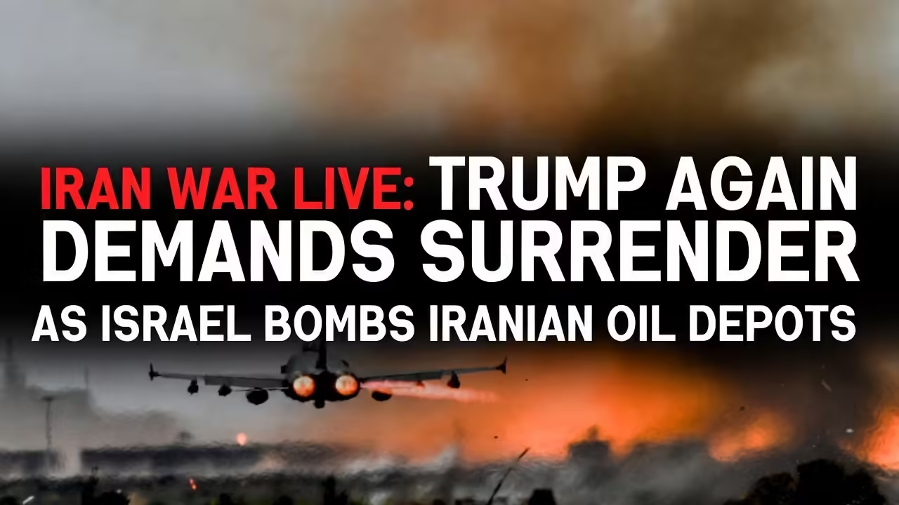
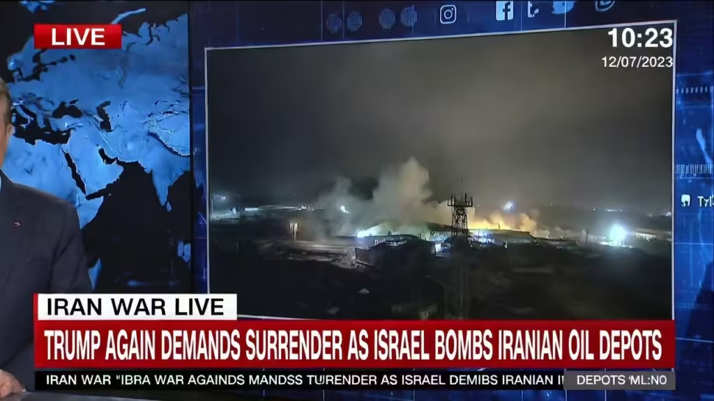
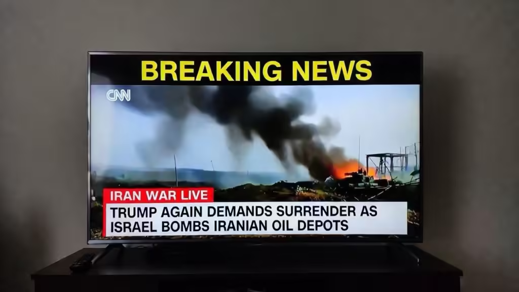
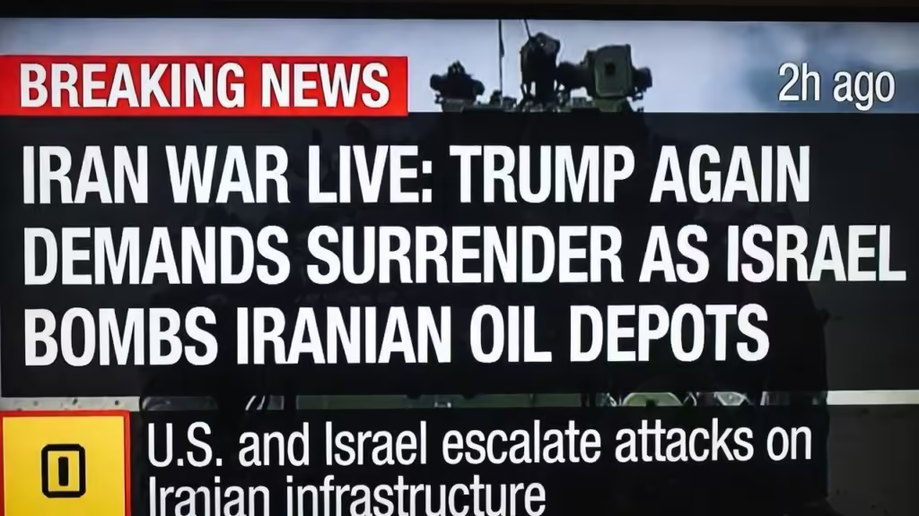
The ongoing Iran war has entered a dangerous new phase as airstrikes intensify and global tensions escalate. On March 8, 2026, new reports confirmed that Israeli forces targeted multiple Iranian oil depots while U.S. President Donald Trump again demanded Iran’s “unconditional surrender.”
The conflict, which began in late February following a coordinated U.S.–Israeli military campaign against Iran’s leadership and military infrastructure, has quickly transformed into one of the most volatile geopolitical crises of the decade.
With thousands of airstrikes, rising civilian casualties, and growing fears of a wider regional war, the Iran war is reshaping global politics, energy markets, and international security.
This live update and analysis explores the latest developments, the causes of the conflict, the strategic goals of the involved powers, and the possible consequences for the Middle East and the world.
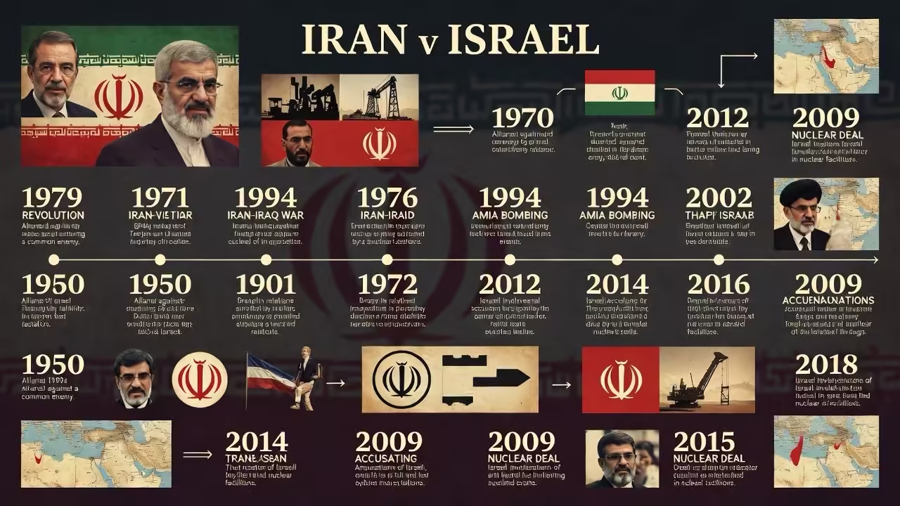
Timeline of the Iran War
How the Conflict Started
The current war began on February 28, 2026, when the United States and Israel launched coordinated airstrikes on Iranian military targets. The attacks reportedly killed Iran’s Supreme Leader, Ayatollah Ali Khamenei, and several senior military officials.
This unprecedented strike triggered a massive response from Tehran. Iran launched missile and drone attacks against Israel and U.S. assets across the Middle East, escalating the conflict into a regional war.
Within days, the situation spiraled as multiple countries became indirectly involved through military bases, alliances, and strategic partnerships.
Trump Demands “Unconditional Surrender”
Washington’s Hardline Position
U.S. President Donald Trump has repeatedly insisted that Iran must surrender completely to end the war. According to statements posted on social media and confirmed by officials, Trump believes only unconditional surrender can guarantee peace.
“There will be no deal with Iran except unconditional surrender,” he wrote in a message addressing the conflict.
The White House argues that Iran’s current government must be replaced by a new leadership that does not threaten regional stability.
Trump has also warned that continued resistance from Tehran could result in devastating military action.
Threats of Further Military Action
Trump has indicated that the war may continue until Iran’s military capabilities are completely destroyed.
In remarks to reporters, he suggested the conflict might end only when Iran no longer has functioning leadership or military command structures.
This statement has alarmed analysts, who warn that such goals could dramatically extend the war and increase civilian casualties.
Israeli Airstrikes Target Iranian Oil Depots
Strategic Energy Infrastructure Hit
One of the most significant developments in the conflict occurred when Israeli forces bombed oil storage depots near Tehran.
Iranian state media reported that a major oil depot in southern Tehran was struck, while another facility in the northwest of the city was also targeted. Flames and thick smoke were seen rising from the facilities after the attacks.
Although nearby refinery infrastructure reportedly avoided major damage, the strikes mark a dramatic escalation in the war.
Why Oil Infrastructure Matters
Iran’s oil industry is the backbone of its economy. By targeting oil depots and energy infrastructure, Israel and its allies aim to:
Disrupt Iran’s financial resources Limit fuel supplies for military operations Increase economic pressure on the government
Energy analysts say these strikes could have major consequences for global oil markets, especially if the conflict spreads to other oil-producing nations.
Iran Rejects Surrender Demand
Iranian officials have strongly rejected the demand for unconditional surrender.
President Masoud Pezeshkian called Trump’s demand a “dream,” insisting that Iran will not capitulate under pressure.
Tehran has emphasized that it is defending itself against foreign aggression and will continue fighting if attacks persist.
Iran Signals Possible De-Escalation
Interestingly, Iran also signaled it might limit its attacks on neighboring countries.
Officials said strikes on Gulf states hosting U.S. military bases would stop unless attacks were launched from those territories.
This announcement suggests Iran may be trying to avoid a wider regional war while still resisting U.S. and Israeli forces.
Massive Air Campaign Across Iran
Israel claims that its military has carried out thousands of strikes during the first week of the war.
According to military officials:
Around 3,400 airstrikes were conducted More than 7,500 munitions were used Key missile launchers and air defenses were destroyed
Israeli leaders say the goal is to dismantle Iran’s military infrastructure and prevent future attacks.
Civilian Impact and Casualties
Rising Death Toll
The humanitarian cost of the conflict is rapidly increasing.
Reports indicate that:
More than 1,200 people have been killed in Iran Dozens have died in Israel and Lebanon Several U.S. service members have also been killed
Thousands of civilians have been displaced as airstrikes hit major cities and infrastructure.
Damage to Cities
Explosions have been reported in several Iranian cities, including:
Tehran Kermanshah Isfahan Bandar Abbas
Witnesses describe heavy bombardment, with buildings shaking and large fires breaking out across urban areas.
Regional Tensions Rising
Gulf States on High Alert
Iran has launched missile and drone strikes toward several Gulf countries hosting U.S. military bases.
Countries affected include:
Saudi Arabia Qatar Bahrain Kuwait
These attacks are believed to target American military facilities rather than civilian infrastructure, but the risk of escalation remains extremely high.
Lebanon and Hezbollah
The conflict is also spreading into Lebanon.
Israel has intensified strikes against Hezbollah positions, claiming the group is assisting Iran’s military operations.
Hundreds of civilians have been killed in Lebanon as the fighting spreads.
Global Economic Impact
Oil Prices Surge
One of the immediate effects of the war has been a dramatic rise in global oil prices.
Energy markets reacted strongly because Iran is a major oil producer and the conflict threatens shipping routes in the Persian Gulf.
Experts warn that if the Strait of Hormuz becomes unsafe, global energy supplies could be severely disrupted.
Impact on Stock Markets
The conflict has also affected global financial markets.
Investors fear:
Long-term energy shortages Global recession risks Supply chain disruptions
Air travel has also been heavily impacted, with thousands of flights canceled across the Middle East.
Intelligence Reports Raise Doubts
Despite the intensity of the bombing campaign, intelligence agencies believe that removing Iran’s government may be extremely difficult.
A classified intelligence report suggests that even large-scale military action is unlikely to overthrow the Iranian regime.
Analysts say Iran has robust succession mechanisms and strong institutional structures that could allow the government to continue operating even after leadership losses.
Possible Scenarios for the Future
Scenario 1: Prolonged Regional War
The most likely scenario is a long war involving multiple countries.
If Iran continues launching missiles and Israel intensifies its attacks, the conflict could spread across the Middle East.
Scenario 2: Regime Change in Iran
The United States appears to support the idea of replacing Iran’s leadership.
However, intelligence experts believe this would be extremely difficult without a ground invasion.
Scenario 3: Negotiated Ceasefire
A ceasefire could eventually occur through international mediation.
Countries such as China, Turkey, or European states might attempt to broker negotiations.
However, Trump’s insistence on unconditional surrender makes diplomatic solutions harder.
Global Reactions
Europe Calls for De-Escalation
European governments have urged both sides to reduce violence and return to diplomatic negotiations.
Many leaders fear that continued escalation could trigger a wider global crisis.
Russia and China Response
Russia and China have criticized the U.S.–Israel military campaign, calling for an immediate ceasefire and respect for Iran’s sovereignty.
These countries may play a major role in shaping the diplomatic outcome of the war.
The Risk of World War
Some analysts warn that the conflict could evolve into a broader international confrontation.
The Middle East hosts numerous military bases from major powers, including the United States, Russia, and European nations.
If the conflict spreads or if additional countries become involved, it could destabilize the entire region.
Humanitarian Crisis
The war is also triggering a growing humanitarian crisis.
Millions of people across the Middle East are now at risk due to:
Displacement Food shortages Infrastructure damage Medical supply disruptions
International aid organizations are warning that conditions could worsen dramatically if the war continues.
Conclusion
The Iran war has rapidly become one of the most dangerous geopolitical crises in recent history.
Israeli strikes on Iranian oil depots and President Trump’s repeated demands for unconditional surrender signal that the conflict is far from ending.
With rising casualties, economic shocks, and mounting regional tensions, the world is watching closely to see whether diplomacy can prevent further escalation.
The coming days will likely determine whether the conflict expands into a wider regional war or moves toward negotiations and peace.
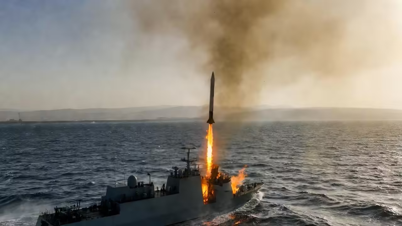
The Persian Gulf has once again become the center of international attention after reports emerged of a missile attack targeting a vessel in the northern Gulf region. According to statements from Iranian state media, Iran’s naval forces launched a missile strike against a vessel they claim was linked to the United States. The announcement has raised serious concerns about maritime security, global trade routes, and the possibility of escalating tensions in one of the world’s most strategically important waterways.
While Iran claims responsibility for the strike, independent verification of the incident remains limited. Meanwhile, maritime monitoring agencies have reported a separate attack on a tanker near the coast of Kuwait. These conflicting reports have created uncertainty about what exactly occurred and who may have been responsible.
Regardless of the details, the situation has once again highlighted the fragile security environment in the Gulf region and the enormous geopolitical importance of the Strait of Hormuz.
The Incident in the Northern Gulf
Early in the morning of March 5, Iranian state television reported that naval units associated with Iran’s Islamic Revolutionary Guard Corps (IRGC) carried out a missile strike against a vessel in the northern Persian Gulf. According to the report, the targeted vessel was allegedly an American ship operating in the region.
Iranian sources claimed the vessel caught fire after the attack and was heavily damaged. Officials linked to the IRGC stated that the strike demonstrated their capability to control and defend strategic waters near Iran’s coastline.
However, these claims have not yet been independently confirmed by international monitoring organizations or foreign governments. As is often the case in rapidly developing regional incidents, information remains limited and sometimes contradictory.
Still, the announcement alone was enough to trigger immediate concern across the global shipping industry and among governments closely monitoring security in the Middle East.
Reports From Maritime Monitoring Agencies
While Iran claimed responsibility for a missile attack, another report emerged from maritime authorities in the region that described a different incident involving a commercial vessel.
The United Kingdom Maritime Trade Operations (UKMTO), an organization responsible for monitoring shipping safety in the region, reported that a tanker near the Kuwaiti coast experienced an explosion on its port side. The vessel had been anchored when the incident occurred.
According to the ship’s captain, a large blast was observed on the left side of the vessel. Following the explosion, a small craft was reportedly seen leaving the area. These observations raised suspicions that the vessel may have been targeted by an attack rather than experiencing a mechanical failure.
The tanker reportedly began taking on water after the explosion, indicating structural damage to the hull. Additionally, oil leakage from one of the cargo tanks was detected, raising environmental concerns about potential marine pollution.
Despite the damage, the situation on board appeared relatively stable. No fire was reported, and the crew members were said to be safe and accounted for.
Authorities and maritime security experts are continuing to monitor the situation while investigating the cause of the blast.
Strategic Importance of the Strait of Hormuz
The Strait of Hormuz is widely considered one of the most strategically important waterways in the world. It serves as the main maritime passage connecting the Persian Gulf with the Gulf of Oman and the Arabian Sea.
This narrow strait plays a critical role in global energy transportation. A significant portion of the world’s oil supply passes through it every day, transported by massive oil tankers traveling between Gulf producers and international markets.
Countries such as Saudi Arabia, Iraq, Kuwait, the United Arab Emirates, and Iran rely heavily on this shipping route for exporting crude oil and other energy products.
Any disruption to traffic in the Strait of Hormuz can have immediate and far-reaching consequences for global energy markets. Even minor security incidents can cause spikes in oil prices and heightened concern among shipping companies.
Because of this, the region is closely monitored by international naval forces, including the United States and several allied nations.
Iran’s Claim of Control Over the Waterway
In its statement following the reported attack, Iranian officials emphasized that they maintain full control over the strategic waters around the Strait of Hormuz.
The IRGC declared that Iran has the capability to monitor and respond to any naval activity in the region. Officials described the waterway as a critical national security zone and reiterated their determination to protect Iranian interests.
Iran has long argued that foreign military presence in the Gulf region threatens regional stability. At the same time, Western governments maintain that naval patrols are necessary to ensure the safety of international shipping lanes.
These competing perspectives have contributed to decades of tension in the region.
History of Maritime Incidents in the Gulf
The Persian Gulf has a long history of maritime confrontations involving regional and international actors.
During the 1980s Iran-Iraq War, the region witnessed the so-called “Tanker War,” during which both sides targeted oil tankers and commercial vessels associated with their opponents. This period saw numerous attacks on shipping and significant disruption to global energy markets.
In more recent years, several vessels have been damaged in mysterious explosions or suspected attacks in the Gulf and nearby waters.
Some incidents involved limpet mines attached to ships, while others involved drone strikes or missile attacks. Responsibility for these attacks has often been disputed, with governments accusing one another of orchestrating the operations.
Because of these past events, any new maritime incident in the Gulf quickly draws global attention.
Impact on Global Shipping and Trade
Shipping companies and energy traders closely monitor security developments in the Persian Gulf because of its critical role in global commerce.
Thousands of vessels pass through the region every year, including oil tankers, container ships, and bulk carriers transporting goods to markets around the world.
When security incidents occur, shipping companies may adjust their routes, increase insurance coverage, or request naval escorts for their vessels. These measures can increase transportation costs and cause delays in the supply chain.
If tensions escalate further, some shipping companies may temporarily avoid the area, which could disrupt international trade flows.
Insurance premiums for vessels operating in the Gulf typically rise whenever conflict risks increase.
Environmental Concerns
The reported oil leakage from the damaged tanker near Kuwait has also raised environmental concerns.
Oil spills can cause severe damage to marine ecosystems, harming fish populations, coral reefs, and coastal habitats. Cleanup operations can take weeks or even months depending on the size of the spill.
The Persian Gulf is already a fragile marine environment due to heavy shipping traffic and oil production activities. Environmental experts warn that additional pollution incidents could worsen existing ecological challenges.
Authorities in the region may need to deploy containment measures quickly if the leak spreads.
Regional Security Implications
The reported attack has heightened tensions in an already sensitive region.
The Gulf is home to multiple rival powers with competing interests, including Iran and several Gulf Arab states. In addition, international forces from the United States, the United Kingdom, and other countries maintain a military presence to protect shipping routes.
Incidents at sea can easily escalate if misinterpretations occur or if countries believe their vessels have been intentionally targeted.
Because naval forces often operate in close proximity to each other in the Gulf, communication and coordination are essential to prevent misunderstandings.
Diplomatic channels may also play a role in reducing tensions following such incidents.
Global Political Reactions
Although the event has not yet been independently confirmed in full detail, governments around the world are likely monitoring the situation closely.
Major energy-importing nations such as China, Japan, and India depend heavily on oil shipments from the Gulf region. Any disruption could affect their economies.
Western governments may also be concerned about the safety of international shipping and the potential risk to naval personnel operating in the region.
International organizations may call for restraint and transparency as more information becomes available.
Uncertainty and Conflicting Information
One of the biggest challenges in understanding incidents like this is the lack of immediate reliable information.
In fast-moving geopolitical situations, reports often emerge from multiple sources with differing details. State media outlets, shipping organizations, and eyewitness reports may provide conflicting accounts.
Independent verification typically takes time as investigators gather evidence and analyze satellite imagery, vessel tracking data, and damage reports.
Until that process is complete, many questions about the incident remain unanswered.
Possible Scenarios
There are several possible explanations for the events reported in the Gulf.
One possibility is that the tanker explosion and the alleged missile attack are connected and part of the same incident. Another possibility is that they are separate events that happened around the same time.
It is also possible that the explosion resulted from another cause, such as an onboard malfunction or accidental collision.
Investigators will likely examine radar records, ship logs, and physical damage to determine exactly what happened.
Maritime Security Measures
Following incidents like this, maritime authorities often issue security advisories to ships operating in the region.
These advisories may include recommendations such as:
Maintaining increased vigilance while sailing in high-risk areas Reporting suspicious vessels or activity immediately Avoiding unnecessary stops in sensitive zones Coordinating with regional naval forces for safety guidance
Shipping companies may also implement additional safety protocols for their crews.
The Role of International Naval Forces
Several international naval coalitions operate in the region to ensure freedom of navigation.
These forces conduct patrols, escort vulnerable vessels, and monitor potential threats to commercial shipping. Their presence is intended to deter attacks and provide rapid response capabilities if incidents occur.
However, the presence of multiple military forces in a relatively confined waterway can also contribute to complex security dynamics.
Maintaining communication between naval forces from different countries is essential to prevent misunderstandings.
Economic Implications
The global economy is highly sensitive to disruptions in energy supply.
If tensions in the Gulf escalate, oil prices could rise quickly due to fears of supply interruptions. Even the perception of risk can influence commodity markets.
Energy traders, shipping companies, and financial analysts will continue monitoring developments closely.
Markets typically react not only to confirmed events but also to political statements and military movements in the region.
The Need for De-Escalation
Many international observers believe that maintaining stability in the Gulf is critical for global economic security.
Diplomatic efforts and open communication channels are often the most effective tools for preventing conflicts from escalating.
Regional cooperation, transparency in investigations, and adherence to international maritime law can help reduce the risk of further incidents.
Conclusion
The reported missile strike and tanker explosion in the northern Gulf have once again highlighted the fragile security environment surrounding one of the world’s most important shipping routes.
Although Iran claims to have targeted an American vessel and asserts control over the Strait of Hormuz, independent confirmation of the details remains limited. Meanwhile, maritime authorities continue investigating the explosion reported near Kuwait.
Regardless of the final findings, the incident has already raised concerns about maritime safety, environmental risks, and geopolitical tensions in the region.
The Persian Gulf remains a critical artery for global trade and energy transportation. Ensuring the safety and stability of this waterway is a shared responsibility that requires cooperation among regional and international stakeholders.
As more information becomes available, the world will be watching closely to see how governments respond and whether tensions in the region escalate or subside.
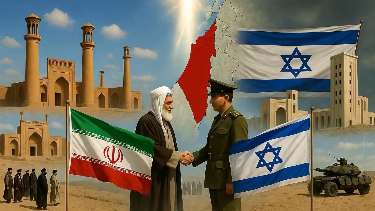
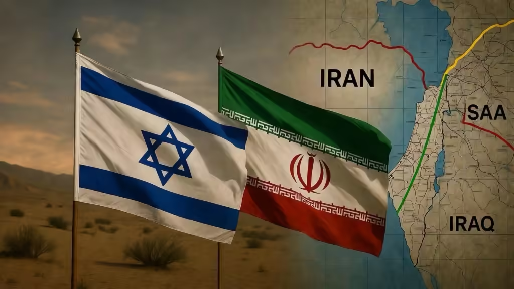
The relationship between Iran and Israel is one of the most complicated and volatile in modern geopolitics. While today the two countries are often described as bitter enemies, this has not always been the case. In fact, for decades they maintained quiet cooperation, shared strategic interests, and even secret military projects.
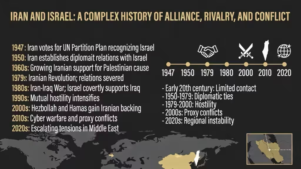
Understanding the Iran–Israel relationship requires examining several historical phases: ancient connections between Persians and Jews, cooperation during the Iranian monarchy, the dramatic shift following the Islamic Revolution of 1979, the rise of proxy conflicts across the Middle East, and the escalation toward direct confrontation in the 21st century.
This article explores the historical roots, political shifts, and evolving tensions that have shaped Iran–Israel relations.
Ancient Connections Between Persians and Jews
The historical relationship between the Persian and Jewish peoples dates back over 2,500 years. One of the earliest connections occurred during the Achaemenid Persian Empire, when the Persian king Cyrus the Great conquered Babylon in 539 BCE.
According to historical sources and biblical accounts, Cyrus allowed Jewish exiles in Babylon to return to Jerusalem and rebuild their temple. This act earned him a positive legacy in Jewish history and is sometimes cited as an early example of cooperation between Persians and Jews.
For centuries afterward, Jewish communities lived throughout Persia (modern Iran). These communities remained a significant minority in the region and contributed to Iranian cultural and economic life.
While these ancient connections do not directly determine modern political relations, they illustrate that the relationship between the two peoples has not always been hostile.
The Birth of Israel and Early Relations (1948–1979)
When Israel was established in 1948, the Middle East entered a new era of geopolitical realignment. Many Arab states rejected Israel’s creation, leading to wars and political tensions across the region.
Iran, however, took a more complex approach.
Although Iran did not fully recognize Israel at first, it maintained pragmatic relations with the Jewish state. Under the rule of Mohammad Reza Shah Pahlavi, Iran was a pro-Western monarchy that sought strong relations with the United States and Western allies.
Israel and Iran shared several strategic interests during this period:
Both countries feared the rise of Arab nationalism. Both opposed Soviet influence in the Middle East. Both sought regional stability and economic cooperation.
Because of these shared concerns, the two states developed a quiet partnership.
Economic and Strategic Cooperation
During the 1950s–1970s, Israel and Iran collaborated in several areas:
Trade and Energy Iran supplied oil to Israel, which lacked natural energy resources. Security Cooperation Intelligence agencies from both countries cooperated against common threats. Military Projects In the late 1970s, the countries even worked on joint weapons programs. One example was Project Flower, a secret missile development effort aimed at expanding Iran’s military capabilities through Israeli technology.
Despite these partnerships, the relationship remained discreet because openly supporting Israel could provoke backlash from Arab states.
Still, by the late 1970s, Iran and Israel had established a practical alliance based on shared strategic interests.
The Islamic Revolution and the Collapse of Relations
The turning point in Iran–Israel relations came in 1979, when the Iranian monarchy was overthrown in the Islamic Revolution.
Led by the cleric Ruhollah Khomeini, the revolution transformed Iran from a pro-Western monarchy into an Islamic Republic with a radically different foreign policy.
One of the new regime’s defining positions was strong opposition to Israel.
Ideological Shift
The revolutionary government framed Israel as an illegitimate state and a symbol of Western influence in the Middle East. Iranian leaders began referring to Israel as the “Zionist regime” and pledged support for Palestinian movements.
Iran quickly severed relations with Israel and transferred Israel’s diplomatic mission in Tehran to representatives of the Palestine Liberation Organization.
This ideological shift fundamentally changed the dynamics of the Middle East.
Where Iran had once been an indirect ally of Israel, it now positioned itself as one of Israel’s most vocal opponents.
Rise of Proxy Conflicts
During the 1980s and 1990s, Iran and Israel rarely confronted each other directly. Instead, the conflict took the form of proxy warfare.
Iran began supporting various groups that opposed Israel, particularly in Lebanon and Palestine.
Hezbollah
One of the most important organizations supported by Iran is Hezbollah, a Shiite militant and political group based in Lebanon.
Formed during the Lebanese Civil War in the 1980s, Hezbollah received financial, military, and ideological backing from Iran. The group became one of Israel’s most significant regional adversaries.
Through Hezbollah, Iran could challenge Israel’s security without direct military confrontation.
Hamas and Palestinian Groups
Iran also provided varying levels of support to Palestinian militant groups such as Hamas.
These alliances reinforced Iran’s image as a defender of Palestinian resistance and strengthened its influence in regional politics.
Israel, in response, increasingly viewed Iran as the central power behind many anti-Israeli movements in the Middle East.
The Nuclear Issue and Rising Tensions
In the early 2000s, the dispute between Iran and Israel intensified due to concerns about Iran’s nuclear program.
Iran insisted that its nuclear activities were intended for peaceful energy purposes. However, Israel and several Western governments feared that Iran could eventually develop nuclear weapons.
Israel considers a nuclear-armed Iran an existential threat.
This concern has driven decades of diplomatic pressure, intelligence operations, and covert actions.
Cyber and Intelligence Warfare
Both countries have engaged in covert operations aimed at weakening the other’s capabilities.
These include:
Cyber attacks Assassinations of scientists Sabotage of military facilities Intelligence operations
Although many of these incidents remain officially unconfirmed, they demonstrate the intensity of the hidden conflict between the two states.
Iran’s Regional Strategy
Iran’s strategy toward Israel is closely tied to its broader regional ambitions.
Tehran seeks influence across the Middle East through a network sometimes described as the “Axis of Resistance.”
This network includes:
Hezbollah in Lebanon Pro-Iran militias in Iraq The Syrian government Various Palestinian groups
By strengthening these alliances, Iran increases pressure on Israel from multiple fronts.
Israel, in turn, has responded with a strategy of preventing Iranian military entrenchment in neighboring countries such as Syria.
This has led to numerous airstrikes against Iranian-linked targets in the region.
Direct Confrontations in the 2020s
For many years, Iran and Israel avoided direct military confrontation. Instead, the conflict remained largely indirect.
However, the 2020s saw a significant escalation.
In April 2024, Iran launched a large-scale drone and missile attack against Israel, marking the first direct attack by Iran on Israeli territory.
The attack involved hundreds of drones and missiles and represented a major turning point in the conflict.
Although many of the projectiles were intercepted, the event demonstrated that tensions had entered a new and more dangerous phase.
The 2025 Twelve-Day War
Another major escalation occurred in June 2025, when Israel launched strikes against Iranian nuclear facilities.
Israel argued that the attacks were necessary to stop Iran from developing nuclear weapons.
Iran responded with missile attacks, leading to a short but intense conflict sometimes referred to as the “Twelve-Day War.”
The fighting involved:
Airstrikes on nuclear and military sites Missile launches regional instability across the Middle East
The conflict ended after international mediation, but tensions remained extremely high.
Diplomatic Efforts and Negotiations
Despite repeated confrontations, diplomatic efforts have continued in parallel.
In 2025 and 2026, negotiations involving the United States and Iran attempted to address the nuclear issue and reduce tensions.
These talks focused on:
limiting uranium enrichment preventing nuclear weapon development reducing military escalation
However, negotiations have repeatedly stalled due to distrust between the parties and disagreements over sanctions and regional security.
Escalation into War in 2026
The conflict reached another dramatic stage in early 2026.
Joint Israeli and U.S. military strikes targeted Iranian military facilities and key officials across several cities.
Iran retaliated with missile and drone attacks against Israel and various U.S. military bases in the region.
The conflict involved multiple actors across the Middle East, highlighting the broader regional stakes.
Reports indicated that the fighting expanded beyond the two countries, affecting several regional states and raising fears of a wider Middle Eastern war.
Global leaders called for de-escalation to prevent a broader regional conflict and disruptions to global energy markets.
Ideological and Strategic Dimensions
The Iran–Israel conflict is not only geopolitical but also ideological.
Iran’s Perspective
Iran’s leadership frames its opposition to Israel as part of a broader struggle against Western influence and in support of Palestinian rights.
Iranian officials frequently portray Israel as a colonial project backed by Western powers.
Israel’s Perspective
Israel views Iran as its most serious long-term security threat.
Israeli leaders argue that:
Iran supports militant groups targeting Israeli civilians Iran seeks regional dominance Iran’s nuclear ambitions threaten Israel’s existence
These fundamentally opposing perspectives make compromise extremely difficult.
Regional and Global Implications
The Iran–Israel conflict has implications far beyond the two countries.
Key global concerns include:
1. Middle East Stability
Because Iran and Israel both have strong regional alliances, any conflict between them risks drawing in other countries.
2. Energy Markets
Iran sits near the Strait of Hormuz, one of the world’s most important oil shipping routes. Conflict in the region can disrupt global energy supplies.
3. Nuclear Proliferation
A nuclear arms race in the Middle East could destabilize the international security system.
4. Global Diplomacy
The conflict influences relations between major powers such as the United States, Russia, China, and European nations.
Possibilities for the Future
The future of Iran–Israel relations remains uncertain.
Several possible scenarios could unfold:
Continued Proxy Conflict The two countries may continue fighting indirectly through regional allies. Direct Military Escalation Larger wars remain possible if tensions continue to rise. Diplomatic Breakthrough Though unlikely in the short term, future political changes could lead to negotiations. Regional Realignment Shifts in alliances within the Middle East could reshape the strategic balance.
Conclusion
The history of Iran and Israel illustrates how rapidly international relationships can transform.
Once quiet partners cooperating on trade, intelligence, and military technology, the two countries became bitter adversaries after the Iranian Revolution of 1979.
Since then, their conflict has evolved through multiple phases—proxy wars, covert operations, nuclear disputes, and increasingly direct confrontations.
Today, Iran and Israel stand at the center of one of the most consequential rivalries in the Middle East. The outcome of this rivalry will shape regional security, global politics, and the future stability of the international system.
Understanding this complex history is essential for interpreting current events and anticipating what might come next.
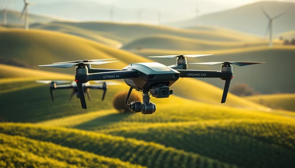
Precision agriculture is revolutionizing the way we grow food. By leveraging advanced technologies like satellites and drones, farmers can now produce more with less. This innovative approach enables them to optimize crop yields while reducing water and chemical usage.
The use of satellites and drones in precision agriculture allows for real-time monitoring and data collection. This data is then used to make informed decisions, ensuring that crops receive exactly what they need to thrive. As a result, precision agriculture is not only boosting food production but also promoting sustainability.
Key Takeaways
Precision agriculture boosts food production while reducing water and chemical usage.
Satellites and drones play a crucial role in precision agriculture, enabling real-time monitoring.
This approach promotes sustainability by optimizing resource allocation.
Precision agriculture is revolutionizing the farming industry.
Advanced technologies are being leveraged to improve crop yields.
The Revolution of Precision Agriculture in Modern Farming
Precision agriculture is transforming the agricultural landscape through data-driven insights. This modern farming approach leverages advanced technology to optimize crop yields, reduce waste, and promote sustainability.
Defining Precision Agriculture and Its Core Principles
Precision agriculture involves the use of advanced technology and data analysis to improve farming efficiency. According to the Food and Agriculture Organization, “precision agriculture is a farming management concept that combines technology, data analysis, and agronomic expertise to optimize crop yields and reduce environmental impact.”
The core principles of precision agriculture include the use of satellite and drone technology, GPS guidance, and data analytics to make informed decisions. This approach enables farmers to monitor and manage their crops more effectively, reducing the need for excessive water and chemicals.
The Shift from Traditional to Data-Driven Farming
The shift from traditional farming methods to data-driven approaches has been significant. As noted by industry experts, “data-driven farming allows for more precise application of resources, resulting in higher yields and lower environmental impact.”
Data-driven farming involves the collection and analysis of data on soil moisture, crop health, and weather patterns. This information is used to optimize irrigation, fertilization, and pest control, leading to more efficient and sustainable farming practices.
The Evolution of Agricultural Technology: From Manual Labor to Digital Fields
From ancient irrigation systems to modern drones, agricultural innovation has continually evolved to meet the world’s growing food demands. This evolution is a testament to human ingenuity and the relentless pursuit of efficiency and sustainability in farming practices.
Historical Context of Farming Innovation
The history of agricultural technology is as old as civilization itself. Early innovations, such as the plow and irrigation systems, marked significant milestones in the development of farming.
As societies grew, so did the need for more efficient farming techniques, leading to the development of new tools and methods. The introduction of the steel plow in the 19th century, for example, revolutionized farming by allowing for deeper and more efficient tilling of the soil.
Key Technological Milestones Leading to Precision Agriculture
The journey towards precision agriculture has been paved with numerous technological advancements. The advent of GPS technology, for instance, enabled farmers to precision-guide their equipment, reducing waste and improving crop yields.
More recently, the integration of drones and satellite imaging has allowed for real-time monitoring of crop health and soil conditions. As
“The future of farming is not just about growing crops; it’s about growing data.”
, said by a leading agricultural technologist, encapsulates the essence of modern agricultural innovation.
The combination of these technologies has set the stage for the next generation of farming practices, where data-driven decision-making is becoming the norm.
Eyes in the Sky: How Satellite Technology Transforms Farming
Satellite technology has revolutionized the agricultural sector by providing farmers with critical data to enhance crop yields and reduce waste. This technological advancement is a cornerstone of precision agriculture, enabling farmers to make informed decisions based on real-time data.
Types of Satellite Data Used in Agriculture
Satellites provide a variety of data that are crucial for agricultural applications. This includes:
Multispectral and hyperspectral imagery for crop health assessment
Thermal imaging for soil moisture monitoring
Synthetic Aperture Radar (SAR) for land deformation and crop monitoring
Remote Sensing and Field Mapping Capabilities
Remote sensing technology allows for the detailed mapping of fields, providing insights into soil types, crop growth, and moisture levels. This information is vital for:
Identifying areas that require irrigation or drainage
Monitoring crop health and detecting issues early
Optimizing fertilizer and pesticide application
Real-time Monitoring and Decision Support Systems
Satellite technology enables real-time monitoring of agricultural fields, allowing farmers to respond quickly to changes in crop conditions. Decision support systems (DSS) use this data to provide recommendations on farming practices, helping to improve yields and reduce environmental impact.
By leveraging satellite technology, farmers can adopt more sustainable practices, contributing to climate change mitigation and environmental conservation. The integration of satellite data into farming operations is a significant step towards a more efficient and sustainable agricultural sector.
The Rise of Agricultural Drones: Capabilities and Applications
The integration of drones in agriculture marks a significant shift towards precision farming. Agricultural drones are equipped with advanced technology that enables farmers to monitor and manage their crops more effectively.
Types of Drones Used in Precision Farming
Precision farming utilizes various types of drones, each designed to serve specific purposes. The choice between fixed-wing and multirotor drones depends on the farm’s needs.
Fixed-Wing vs. Multirotor Drones for Different Farm Needs
Fixed-wing drones are ideal for covering large areas and are often used for aerial imaging. Multirotor drones, on the other hand, offer more flexibility and are used for tasks that require more maneuverability.
Specialized Sensors and Equipment
Drones can be equipped with specialized sensors and equipment, such as multispectral or hyperspectral cameras, to capture detailed data on crop health and growth.
Aerial Imaging and Crop Assessment Functions
Aerial imaging is a key function of agricultural drones, allowing farmers to assess crop health, detect issues early, and make informed decisions. This technology enables the creation of detailed maps and surveys of the land.
Targeted Application of Resources via Drone Technology
Drones enable the targeted application of resources such as fertilizers and pesticides, reducing waste and minimizing environmental impact. This precision application is a significant step towards more sustainable farming practices.
By leveraging drone technology, farmers can not only improve crop yields but also contribute to a more environmentally friendly agricultural practice.
Boosting Crop Yields: Data-Driven Approaches to Food Production
Data-driven farming is revolutionizing the way we produce food, making it possible to boost crop yields while minimizing environmental impact. By leveraging advanced technologies and data analysis, farmers can now make informed decisions to optimize crop production.
Precision Seeding and Planting Techniques
Precision seeding involves using data and technology to optimize the planting process. This includes:
Soil analysis to determine the best seed varieties
Precision planting equipment to ensure accurate seed placement
Data-driven decisions on planting density and timing
These techniques help in achieving uniform crop emergence and maximizing yields.
Crop Health Monitoring and Yield Prediction
Crop health monitoring is crucial for early detection of issues that could impact yield. This involves:
Early Disease Detection Systems
Advanced sensors and drones equipped with multispectral or hyperspectral cameras can detect early signs of disease or stress in crops, allowing for timely intervention.
Harvest Timing Optimization
Data analytics and predictive models help farmers determine the optimal time for harvesting, ensuring that crops are picked at the peak of maturity, thus maximizing yield and quality.
By adopting these data-driven approaches, farmers can significantly improve crop yields while promoting sustainable agricultural practices.
Water Conservation Through Precision Irrigation Systems
Smart irrigation technologies are transforming the way farmers manage water resources, enabling them to conserve water while maintaining crop health. Precision irrigation systems utilize advanced technologies to optimize water application, reducing waste and ensuring that crops receive the right amount of moisture.
Smart Water Management Technologies
Smart water management involves the use of sensors, IoT devices, and data analytics to monitor soil moisture levels, weather conditions, and crop water requirements. This information is used to create optimized irrigation schedules, ensuring that water is applied efficiently.
Soil moisture sensors provide real-time data on soil conditions.
Weather stations offer forecasts and current weather conditions.
Data analytics platforms process information to create personalized irrigation plans.
Soil Moisture Monitoring and Targeted Irrigation
Soil moisture monitoring is crucial for targeted irrigation. By understanding the moisture levels in the soil, farmers can avoid over-irrigation, which wastes water and can lead to root rot and other problems.
Drip Irrigation and Micro-Sprinkler Systems
Drip irrigation and micro-sprinkler systems deliver water directly to the roots of plants, minimizing evaporation and runoff. These systems are highly efficient and can be controlled precisely using smart irrigation controllers.
Weather-Based Irrigation Scheduling
Weather-based irrigation scheduling adjusts irrigation plans according to weather forecasts, ensuring that farmers don’t irrigate during rainy periods or when high winds might cause excessive evaporation.
By adopting precision irrigation systems, farmers can significantly contribute to water conservation efforts while maintaining healthy crops and improving their bottom line through reduced water waste.
Reducing Chemical Usage with Targeted Application Methods
The agricultural sector is witnessing a significant shift towards reducing chemical usage through targeted application methods. This approach not only helps in minimizing the environmental footprint of farming but also contributes to more efficient use of resources.
Precision Spraying Technologies
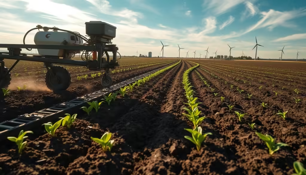
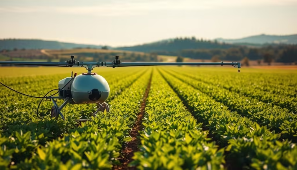
Precision spraying technologies have emerged as a crucial tool in modern agriculture. These technologies enable farmers to apply chemicals precisely where they are needed, reducing waste and minimizing the impact on the environment. Precision spraying involves the use of GPS-guided systems and sensors to ensure accurate application.
Technology
Description
Benefits
GPS-Guided Sprayers
Use GPS for precise navigation and application
Reduced overlap, increased accuracy
Sensor-Based Systems
Detect weeds, diseases, and pests for targeted treatment
Minimized chemical usage, cost savings
Integrated Pest Management Using Technology
Integrated Pest Management (IPM) is a holistic approach that combines different strategies to manage pests effectively. Technology plays a vital role in IPM by providing tools for monitoring, predicting, and controlling pest populations.
Spot Treatment vs. Broadcast Application
Spot treatment involves applying chemicals directly to the affected areas, whereas broadcast application spreads chemicals over the entire field. Spot treatment is more efficient and environmentally friendly.
Reducing Environmental Contamination
By adopting targeted application methods, farmers can significantly reduce environmental contamination. This approach helps in protecting water bodies, soil health, and biodiversity.
“The use of precision agriculture technologies, including precision spraying, is a game-changer for reducing chemical usage in farming.”
The integration of precision spraying technologies and IPM strategies is revolutionizing the way farming is done. By minimizing chemical usage, farmers can not only reduce their environmental impact but also improve crop yields and quality.
Earth Technology and Sustainability: How Precision Agriculture Supports Green Tech Goals
As the world grapples with climate change, precision agriculture emerges as a critical tool for sustainability. By leveraging advanced technologies like satellites and drones, farmers can now adopt practices that not only boost crop yields but also reduce their environmental footprint.
Reducing Agriculture's Environmental Footprint
Precision agriculture enables farmers to use resources more efficiently, reducing waste and minimizing the use of chemicals and water. Targeted application of fertilizers and pesticides means less runoff into waterways, protecting local ecosystems.
“The use of precision agriculture has allowed us to cut down on unnecessary chemical applications, which not only saves us money but also helps in preserving the environment,” says a farmer who has adopted these practices.
Contribution to Climate Change Mitigation
Precision agriculture plays a significant role in climate change mitigation through various practices. Two key areas of focus are carbon sequestration and reducing greenhouse gas emissions.
Carbon Sequestration Potential
By optimizing soil health through precision farming techniques, soils can become significant carbon sinks. Practices like no-till or reduced-till farming, cover cropping, and organic amendments enhance soil’s carbon sequestration potential.
Reducing Greenhouse Gas Emissions from Farming
Precision agriculture helps in reducing emissions by optimizing the use of machinery and fertilizers. For instance, precision application of nitrogen fertilizers reduces nitrous oxide emissions, a potent greenhouse gas.
As we move forward, the integration of precision agriculture with other sustainable practices will be crucial in our fight against climate change, supporting broader green tech goals.
The adoption of precision agriculture has led to remarkable success stories among farmers, showcasing the potential of technology in farming. Farmers are now able to make data-driven decisions, optimizing their crop yields and reducing waste.
Large-Scale Commercial Farm Implementations
Large commercial farms have been at the forefront of adopting precision agriculture technologies. These farms have seen significant improvements in efficiency and productivity. For instance, the use of satellite imaging and GPS-guided equipment has enabled farmers to monitor and manage their crops more effectively.
Small and Medium Farm Adaptations
Small and medium-sized farms are also benefiting from precision agriculture. These farms often face challenges in terms of resource constraints, but they are finding innovative ways to adapt precision agriculture technologies to their needs.
Cost-Effective Solutions for Smaller Operations
Smaller farms are leveraging cost-effective solutions such as drone technology and mobile apps to monitor crop health and manage resources. These technologies are providing them with the data they need to make informed decisions without breaking the bank.
Cooperative Models for Technology Access
Some small and medium-sized farms are forming cooperatives to share resources and access precision agriculture technologies. This collaborative approach is helping them overcome the barriers to adoption and benefit from economies of scale.
Farm Size
Precision Agriculture Technologies
Benefits
Large-Scale
Satellite Imaging, GPS-Guided Equipment
Increased Efficiency, Productivity
Small and Medium
Drone Technology, Mobile Apps
Cost-Effective, Data-Driven Decisions
Challenges and Limitations in Implementing Precision Agriculture
Despite its potential, precision agriculture faces several challenges that hinder its widespread adoption. The integration of advanced technologies such as satellites and drones into farming practices requires significant investment in infrastructure and technical expertise.
Technical Barriers and Infrastructure Requirements
One of the primary challenges is the lack of adequate infrastructure in rural areas, including reliable internet connectivity and sufficient data storage facilities. Additionally, the cost of acquiring and maintaining precision agriculture technology can be prohibitively expensive for many farmers.
Technical Barrier
Description
Impact
Limited Internet Connectivity
Insufficient internet access in rural areas
Hinders data transfer and real-time monitoring
High Cost of Technology
Expensive equipment and maintenance costs
Unaffordable for small and medium-sized farms
Accessibility Issues for Small and Medium-sized Farms
Small and medium-sized farms often face significant barriers to adopting precision agriculture due to limited financial resources and lack of technical knowledge. This can lead to a digital divide, where larger farms reap the benefits of precision agriculture while smaller farms are left behind.
Addressing these challenges will be crucial to ensuring that the benefits of precision agriculture are accessible to all farmers, regardless of their farm size or resources.
Conclusion: The Future of Farming in a Technology-Driven World
The future of farming is being reshaped by technology, with precision agriculture at the forefront of this revolution. By harnessing the power of satellites, drones, and data-driven approaches, the agricultural sector is becoming more productive, sustainable, and environmentally friendly.
As we move forward, the integration of technology in farming will continue to play a vital role in achieving Sustainability and Green Tech goals. With the global population projected to reach 9.7 billion by 2050, the need for efficient and sustainable food production methods has never been more pressing.
Technology-Driven Agriculture is not only enhancing crop yields but also reducing the environmental footprint of farming. By adopting precision agriculture practices, farmers can minimize waste, conserve water, and reduce the use of chemicals, contributing to a more sustainable food system.
The Future of Farming looks promising, with ongoing innovations and advancements in precision agriculture. As the industry continues to evolve, it is essential for farmers, policymakers, and stakeholders to work together to ensure that the benefits of technology are accessible to all, promoting a more sustainable and food-secure future.
FAQ
What is precision agriculture?
Precision agriculture is a farming practice that uses advanced technology, such as satellites and drones, to optimize crop yields and reduce waste.
How do satellites contribute to precision agriculture?
Satellites provide critical data on soil moisture, crop health, and weather patterns, enabling farmers to make informed decisions about planting, irrigation, and harvesting.
What types of drones are used in precision farming?
Both fixed-wing and multirotor drones are used in precision farming, each with its own strengths and applications, such as aerial imaging and crop assessment.
How does precision irrigation conserve water?
Precision irrigation systems use soil moisture monitoring and weather data to optimize water application, reducing waste and conserving this valuable resource.
Can precision agriculture help reduce chemical usage?
Yes, precision agriculture enables targeted application of chemicals, such as fertilizers and pesticides, reducing the overall amount used and minimizing environmental impact.
What are the benefits of precision seeding and planting?
Precision seeding and planting techniques optimize crop spacing, depth, and timing, leading to improved yields and reduced waste.
How does precision agriculture support sustainability?
By reducing waste, conserving water, and minimizing chemical usage, precision agriculture contributes to a more sustainable food production system.
What are the challenges in implementing precision agriculture?
Technical barriers, infrastructure requirements, and accessibility issues for small and medium-sized farms are some of the challenges faced in implementing precision agriculture.
Are there cost-effective solutions for smaller farms?
Yes, cooperative models and cost-effective technologies are emerging to make precision agriculture more accessible to smaller farms.
How can farmers access precision agriculture technology?
Farmers can access precision agriculture technology through various means, including equipment suppliers, agricultural service providers, and cooperative models.
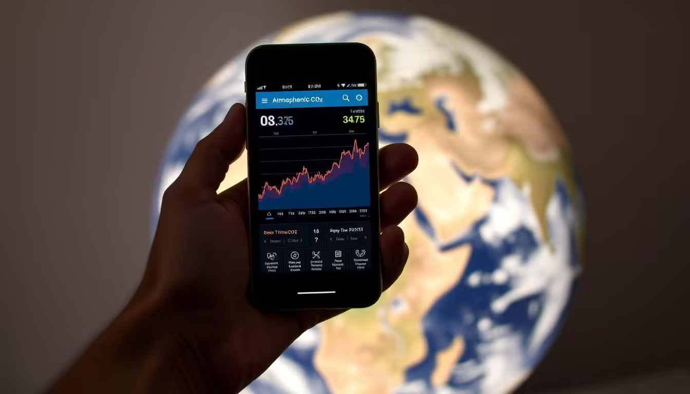
Monitoring CO₂ levels has become more accessible thanks to mobile apps connected to global climate data. These apps allow individuals to track the concentration of CO₂ in the atmosphere, providing valuable insights into the impact of human activities on the environment.
By leveraging climate data, these apps contribute to a better understanding of climate change and its effects on sustainability. This information is crucial for making informed decisions about reducing our carbon footprint.
Key Takeaways
Mobile apps can monitor CO₂ levels using global climate data.
Tracking CO₂ concentrations helps understand human impact on the environment.
Climate data insights support sustainability efforts.
These apps make climate change data more accessible.
Informed decisions can be made using the data from these apps.
The Rising Importance of Monitoring Carbon Dioxide Levels
With climate change being a pressing global issue, understanding and monitoring CO₂ levels is vital. The impact of human activities on the environment has led to a significant increase in carbon dioxide emissions, contributing to global warming and associated climate changes.
Understanding CO₂’s Role in Climate Change
Carbon dioxide is a greenhouse gas that traps heat in the atmosphere, leading to a rise in global temperatures. The increasing levels of CO₂, primarily due to burning fossil fuels and deforestation, have been identified as a major contributor to climate change. Understanding the role of CO₂ in climate change is crucial for developing effective mitigation strategies.
By monitoring CO₂ levels, scientists and policymakers can better understand the impact of human activities on the climate and make informed decisions to reduce emissions.
Why Personal Monitoring Matters
Personal monitoring of CO₂ levels empowers individuals to take action against climate change. By being aware of their carbon footprint, individuals can make lifestyle changes to reduce their impact on the environment. This collective action can lead to significant positive changes when combined with broader societal and governmental efforts.
Moreover, personal monitoring encourages a culture of sustainability and environmental stewardship, promoting a community-wide commitment to reducing carbon emissions.
How Mobile Technology is Transforming Earth’s Climate Monitoring
The advent of mobile technology has revolutionized the way we monitor Earth’s climate, making it more accessible and efficient. With the proliferation of smartphones and mobile apps, individuals can now contribute to and access climate data in real-time.
The Evolution of Environmental Monitoring Tools
Traditionally, environmental monitoring was the domain of scientists and researchers using specialized equipment. However, with the integration of Green Tech and mobile technology, the landscape has changed dramatically. Mobile devices now enable the collection of diverse data types, from air quality to CO₂ levels, using apps that can be operated by anyone.
Democratizing Access to Climate Data
One of the most significant impacts of mobile technology on climate monitoring is the democratization of access to climate data. Through various mobile apps, people can now access real-time data on Climate Change indicators, understand their Environment, and make informed decisions. This accessibility fosters a more engaged and aware public, crucial for addressing the challenges posed by Climate Change.
Furthermore, the use of mobile technology in climate monitoring encourages community involvement and participation in environmental conservation efforts. By leveraging Technology, we can build a more sustainable future.
Top Mobile Apps for Tracking Earth’s CO₂ Levels
Climate change awareness has prompted the creation of various mobile apps designed to track and monitor Earth’s CO₂ levels. These apps not only provide real-time data on carbon dioxide concentrations but also offer insights into climate change and its impacts on the environment.
NASA’s GEOS App
NASA’s GEOS App is a powerful tool for monitoring Earth’s atmosphere. It provides users with real-time data on CO₂ levels, along with other atmospheric components.
Key Features and Data Sources
The app’s key features include real-time global modeling and data assimilation. It sources its data from NASA’s Goddard Earth Observing System (GEOS).
User Experience and Accessibility
The app is designed to be user-friendly, making it accessible to a wide range of users, from scientists to the general public.
Carbon Footprint Calculator Apps
Carbon footprint calculator apps help individuals and organizations track their emissions. They provide personalized recommendations for reducing carbon footprints.
Personal Emissions Tracking
These apps track daily emissions based on user inputs such as energy consumption, travel, and lifestyle choices.
Reduction Recommendations
They offer tailored advice on how to reduce emissions, including energy-efficient practices and sustainable lifestyle changes.
Earth Observer and Climate Trackers
Earth observer and climate tracker apps provide comprehensive data on Earth’s climate. They often include features for monitoring CO₂ levels, weather patterns, and more.
Global Monitoring Capabilities
These apps have the capability to monitor climate parameters globally, offering a broad perspective on climate change.
Visualization Tools
They include visualization tools that help users understand complex climate data through interactive maps and graphs.
App Name
Key Features
Data Sources
NASA’s GEOS App
Real-time global modeling, data assimilation
NASA’s GEOS
Carbon Footprint Calculator
Personal emissions tracking, reduction recommendations
User inputs
Earth Observer
Global monitoring, visualization tools
Various climate databases
Citizen Science Platforms
Citizen science platforms engage the public in climate monitoring. They allow users to contribute to and access climate data.
Collaborative Data Collection
These platforms facilitate collaborative data collection efforts, enabling a wider understanding of climate phenomena.
Community Engagement Features
They include features that foster community engagement, such as discussion forums and project sharing.
Air Quality and CO₂ Monitoring Apps
Air quality and CO₂ monitoring apps focus on local and global air quality. They provide information on CO₂ levels and other pollutants.
Local vs. Global Measurements
These apps often differentiate between local and global measurements, giving users a nuanced view of air quality.
Health Impact Information
They also provide information on the health impacts of air quality, helping users make informed decisions.
How These Apps Connect to Global Climate Data Networks
The connection between mobile apps and global climate data networks is revolutionizing how we monitor Earth’s CO₂ levels. By leveraging advanced technology and global data networks, these apps provide users with real-time insights into climate change.
Satellite Integration and Real-Time Monitoring
Satellite integration plays a crucial role in climate monitoring. Satellites orbiting the Earth capture vast amounts of data on CO₂ levels, which are then transmitted to global climate data networks. Mobile apps connected to these networks can access real-time data, enabling users to monitor climate change as it happens. Real-time monitoring is essential for understanding the dynamics of climate change and for making informed decisions.
The use of satellites in climate monitoring has significantly advanced our ability to track CO₂ levels globally. This technology, combined with mobile apps, represents a significant step forward in Green Tech innovations.
Ground Station Data Collection Methods
In addition to satellite data, ground station data collection methods provide another critical source of information on CO₂ levels. Ground stations are equipped with sensors that measure CO₂ concentrations in the atmosphere. This data is then fed into global climate data networks, supplementing satellite data and providing a more comprehensive view of climate change.
The combination of satellite and ground station data allows for more accurate monitoring and forecasting of climate change. Mobile apps that tap into these data sources empower users to stay informed about the Environment and take action against climate change.
The Science Behind Measuring Earth’s CO₂ Levels and Climate Change
Understanding the science behind measuring Earth’s CO₂ levels is crucial in the fight against climate change. As we discussed in previous sections, mobile apps play a significant role in monitoring CO₂ levels, but it’s equally important to comprehend the science that supports these technologies.
The measurement of CO₂ levels involves understanding the concentration of carbon dioxide in the atmosphere, typically expressed in parts per million (PPM). This measurement is critical because it helps scientists and policymakers track the progress of climate change mitigation efforts.
Understanding Parts Per Million (PPM) Measurements
PPM is a unit of measurement that represents the number of CO₂ molecules per million molecules of air. To put this into perspective, pre-industrial CO₂ levels were around 280 PPM. Today, they have surpassed 415 PPM, a significant increase that underscores the urgency of addressing climate change.
Measuring CO₂ in PPM allows for the tracking of changes in the atmosphere over time. This data is vital for understanding the impact of human activities on the environment and for developing effective strategies to reduce our carbon footprint.
Historical CO₂ Data and Current Trends
Historical CO₂ data provides valuable insights into how the Earth’s atmosphere has changed over time. By analyzing ice cores and other records, scientists have reconstructed CO₂ levels dating back hundreds of thousands of years.
Year
CO₂ Level (PPM)
Change
1960
316.9
–
1980
338.7
+21.8
2000
369.4
+30.7
2020
414.4
+45.0
Interpreting the Data You See
When using mobile apps to monitor CO₂ levels, it’s essential to understand the data being presented. Look for trends rather than isolated readings, and consider the sources of the data to ensure accuracy.
By interpreting CO₂ data correctly, individuals can make informed decisions about their environmental impact and contribute to a more sustainable future.
Practical Uses for CO₂ Monitoring Apps in Sustainability Efforts
With the rise of green tech, mobile apps that track CO₂ levels are revolutionizing the way we approach environmental sustainability. These apps not only provide real-time data on carbon dioxide levels but also empower users to make informed decisions that contribute to a more sustainable future.
Making Informed Environmental Decisions
CO₂ monitoring apps enable individuals and organizations to track their carbon footprint and make data-driven decisions to reduce their environmental impact. By understanding their CO₂ emissions, users can identify areas for improvement and implement strategies to minimize their carbon footprint.
For instance, a company might use these apps to monitor the CO₂ emissions from their transportation fleet and decide to switch to more fuel-efficient vehicles or optimize their routes to reduce fuel consumption.
Educational Applications
These apps also have significant educational value, teaching users about the importance of reducing CO₂ emissions and promoting sustainable practices. Educational institutions can integrate these apps into their curricula to provide students with hands-on experience in environmental monitoring and sustainability.
Educational Use
Description
Benefits
Curriculum Integration
Incorporating CO₂ monitoring apps into school curricula
Hands-on learning, real-world applications
Project-Based Learning
Using apps for student projects on sustainability
Enhanced engagement, practical skills
Community Engagement
Engaging local communities in CO₂ monitoring efforts
Raises awareness, fosters community action
Community Science Initiatives
CO₂ monitoring apps can also facilitate community science initiatives by enabling citizens to contribute to environmental monitoring efforts. By collecting data from various locations, these apps help build a more comprehensive picture of CO₂ levels and their impact on local environments.
Community-driven projects can raise awareness about environmental issues and promote collective action towards sustainability. For example, a community might use a CO₂ monitoring app to track air quality during a local event and use the data to advocate for cleaner practices.
Green Tech Innovations in Climate Monitoring
The green tech revolution is transforming climate monitoring with innovative solutions. As the world grapples with the challenges of climate change, advancements in green technology are playing a pivotal role in enhancing our ability to monitor and understand environmental shifts.
Next-Generation Sensors and Devices
One of the most significant developments in green tech is the creation of next-generation sensors and devices. These cutting-edge tools are designed to provide more accurate and real-time data on CO₂ levels and other environmental factors. For instance, low-cost air quality sensors are now being deployed in various parts of the world, enabling communities to monitor their local environment more effectively.
Enhanced accuracy and sensitivity
Real-time data transmission
Low power consumption
Compact and portable design
“The future of climate monitoring lies in the intersection of technology and environmental science.”
AI and Machine Learning Applications
Another critical area where green tech is making a significant impact is in the application of AI and machine learning. These technologies are being used to analyze vast amounts of climate data, identify patterns, and predict future trends. For example, AI algorithms can process satellite data to track deforestation or monitor ocean health.
Improved data analysis capabilities
Enhanced predictive modeling
Automated anomaly detection
By leveraging these technologies, researchers and policymakers can make more informed decisions about environmental conservation and climate mitigation strategies.
Challenges and Future Developments in Mobile Environmental Monitoring
As mobile environmental monitoring continues to grow, it’s essential to address the challenges that come with it. The increasing use of mobile apps to track Earth’s CO₂ levels and other environmental factors has brought about several issues that need to be resolved to ensure the continued effectiveness of these technologies.
Data Accuracy and Standardization Issues
One of the primary challenges facing mobile environmental monitoring is ensuring the accuracy and standardization of the data collected. Different devices and apps may use varying methods to measure CO₂ levels, which can lead to inconsistencies in the data. To address this, efforts are being made to standardize measurement protocols and calibrate devices to ensure accuracy.
Bridging the Gap Between Information and Action
Another significant challenge is translating the information gathered through mobile environmental monitoring into tangible actions. While having access to real-time CO₂ data is valuable, it is equally important to encourage individuals and communities to make environmentally conscious decisions based on this information. By integrating educational components into these apps and providing actionable insights, we can bridge the gap between data collection and sustainable practices.
Conclusion: Empowering Climate Action Through Technology
As we navigate the complexities of Climate Change, it’s clear that Technology plays a vital role in the quest for Sustainability. Mobile apps connected to global climate data have emerged as powerful tools, enabling individuals to monitor Earth’s CO₂ levels and make informed decisions about their Environment.
By leveraging Green Tech innovations, such as next-generation sensors and AI-driven insights, these apps provide a window into the health of our planet. They not only raise awareness about Climate Change but also empower users to take action, fostering a sense of community and shared responsibility for the Environment.
As we move forward, it’s essential to continue developing and utilizing these technologies to drive Sustainability efforts. By doing so, we can create a more environmentally conscious world, where Technology serves as a catalyst for positive change.
The future of climate action is in our hands, and with the help of mobile apps and global climate data, we can work together to protect the Earth and ensure a sustainable tomorrow.
FAQ
What are the most effective mobile apps for monitoring Earth’s CO₂ levels?
Some of the top mobile apps for tracking CO₂ levels include NASA’s GEOS App, Carbon Footprint Calculator Apps, Earth Observer, and Air Quality and CO₂ Monitoring Apps.
How do mobile apps connect to global climate data networks?
Mobile apps connect to global climate data networks through satellite integration and real-time monitoring, as well as ground station data collection methods.
What is the significance of monitoring CO₂ levels in climate change?
Monitoring CO₂ levels is crucial in understanding its role in climate change, and individual actions can collectively make a difference in mitigating climate change.
How can CO₂ monitoring apps be used in sustainability efforts?
CO₂ monitoring apps can be used to make informed environmental decisions, for educational purposes, and in community science initiatives to promote sustainability.
What are some of the challenges faced by mobile environmental monitoring?
Some of the challenges include data accuracy and standardization issues, as well as the need to bridge the gap between information and action.
How can I interpret the CO₂ data I see on these apps?
Understanding parts per million (PPM) measurements, historical CO₂ data, and current trends can help you interpret the data you see on CO₂ monitoring apps.
Are there any citizen science platforms available for climate monitoring?
Yes, there are citizen science platforms that allow for collaborative data collection and community engagement in climate monitoring efforts.
What role do AI and machine learning play in climate monitoring?
AI and machine learning are being used to enhance climate monitoring capabilities, including data analysis and prediction.
Volcanic eruptions can be catastrophic, causing widespread destruction and loss of life. However, with advancements in satellite technology, it’s now possible to detect early warning signs of an impending eruption. Infrared cameras on satellites play a crucial role in this process, monitoring the Earth’s surface for signs of heat emanating from volcanoes.
This cutting-edge technology enables scientists to track changes in volcanic activity, providing critical insights that can help predict when an eruption is likely to occur. By leveraging green tech innovations, researchers can better understand the complex processes surrounding volcanic eruptions, ultimately contributing to a more sustainable approach to monitoring and mitigating the impact of these natural disasters on the environment.
Key Takeaways
Infrared cameras on satellites detect heat from volcanoes, providing early warnings for eruptions.
Advancements in satellite technology have improved the ability to predict volcanic activity.
Green tech innovations play a crucial role in monitoring and understanding volcanic eruptions.
Early detection can help mitigate the impact of volcanic eruptions on the environment.
Satellite technology contributes to a more sustainable approach to disaster management.
The Science Behind Volcanic Eruptions and Warning Signs
Understanding the science behind volcanic eruptions is crucial for predicting when and how they will occur. Volcanic eruptions are complex geological events influenced by the movement of the Earth’s tectonic plates.
Understanding Volcanic Activity Cycles
Volcanic activity cycles refer to the patterns and periods of eruption and dormancy that a volcano undergoes. These cycles can be influenced by various factors, including the movement of magma beneath the surface and the pressure build-up in the volcanic system. By studying these cycles, scientists can gain insights into the likelihood and potential timing of future eruptions.
Magma movement and pressure build-up
Patterns of historical eruptions
Seismic activity indicators
Pre-eruption Heat Signatures
Before a volcanic eruption, there are often signs of increased heat emanating from the volcano. These pre-eruption heat signatures can be detected using advanced technologies, including infrared cameras on satellites. The heat signatures are a result of magma moving closer to the surface, causing an increase in temperature that can be measured and analyzed.
“The use of infrared technology has revolutionized the field of volcanology, allowing for the early detection of volcanic activity.” – Dr. Jane Smith, Volcanologist
Infrared Technology: Eyes in the Sky
Infrared technology has revolutionized the way we monitor volcanic activity from space. By detecting heat signatures, satellites can identify changes in volcanic behavior that may signal an impending eruption.
How Infrared Imaging Works
Infrared imaging works by capturing the thermal radiation emitted by objects. All objects emit some level of thermal radiation, and the amount of radiation increases with temperature. Infrared sensors on satellites detect this radiation and convert it into images that represent the heat distribution across the observed area.
The process involves sophisticated sensors that are designed to detect even slight variations in temperature. This capability is crucial for monitoring volcanic activity, as it allows scientists to identify subtle changes that may indicate increased volcanic unrest.
Technology
Application
Benefits
Infrared Imaging
Volcanic Activity Monitoring
Early Detection of Eruptions
Thermal Sensors
Satellite-Based Monitoring
Global Coverage
Satellite-Based Thermal Sensors
Satellite-based thermal sensors are specifically designed to detect the thermal radiation emitted by volcanic regions. These sensors are equipped on satellites that orbit the Earth, providing global coverage of volcanic activity.
The data collected by these sensors is transmitted back to Earth, where it is analyzed by scientists to identify potential volcanic eruptions. The use of satellite-based thermal sensors has significantly improved our ability to predict volcanic activity, thereby enhancing disaster management and community safety.
Satellite Systems Monitoring Volcanic Activity
Satellite technology has revolutionized the way we monitor volcanic activity, providing critical early warnings for potentially catastrophic eruptions. This advancement is largely due to the deployment of sophisticated satellite systems by space agencies around the world.
Several key players are involved in this endeavor. NASA’s Earth Observation Satellites play a crucial role in monitoring volcanic activity. These satellites are equipped with advanced infrared sensors that can detect the heat signatures of volcanoes, even when they are obscured by cloud cover or other environmental factors.
NASA’s Earth Observation Satellites
NASA’s Earth Observing System (EOS) includes a series of satellites designed to monitor various aspects of the Earth’s environment, including volcanic activity. The EOS satellites are equipped with instruments such as the Moderate Resolution Imaging Spectroradiometer (MODIS), which can detect thermal anomalies associated with volcanic eruptions.
European Space Agency’s Sentinel Program
The European Space Agency’s (ESA) Sentinel program is another critical component of global volcanic monitoring. The Sentinel satellites are part of the Copernicus program, a joint initiative between the ESA and the European Commission. These satellites provide high-resolution images and data on volcanic activity, contributing significantly to early warning systems.
Other International Monitoring Systems
In addition to NASA and ESA, other countries and international organizations operate satellite systems that contribute to volcanic activity monitoring. For example, Japan’s Himawari series and the United States’ Geostationary Operational Environmental Satellite (GOES) series provide continuous monitoring of volcanic regions. This international cooperation enhances the global capacity to predict and respond to volcanic eruptions, ultimately contributing to climate change research and disaster management.
From Data to Early Warnings: The Detection Process
Detecting thermal anomalies is the first step in generating critical early warnings for volcanic activity. The detection process involves several key components that work together to provide timely and accurate information.
Thermal Anomaly Detection Algorithms
Advanced algorithms are used to identify thermal anomalies from satellite data. These algorithms analyze changes in temperature patterns, helping to pinpoint areas of increased volcanic activity. By detecting these anomalies, scientists can identify potential eruptions before they occur.
Real-time Data Processing and Analysis
Real-time data processing is crucial for timely early warnings. Satellites continuously monitor volcanic regions, sending data back to Earth for analysis. Advanced processing systems analyze this data quickly, providing up-to-date information on volcanic activity.
Verification and Confirmation Protocols
To ensure the accuracy of early warnings, verification and confirmation protocols are in place. These protocols involve cross-checking data from multiple sources and using ground-based observations to validate satellite data. This multi-step verification process helps to minimize false alarms and ensure that early warnings are reliable.
Detection Component
Description
Importance
Thermal Anomaly Detection Algorithms
Identify changes in temperature patterns
High
Real-time Data Processing
Analyze satellite data quickly
High
Verification Protocols
Cross-check data for accuracy
High
By combining these elements, the detection process provides critical early warnings that help protect communities and the environment from the impacts of volcanic eruptions.
Critical Early Warning Systems for Earth’s Most Dangerous Volcanoes
Earth’s most dangerous volcanoes require sophisticated early warning systems to mitigate the impact of eruptions. These systems are crucial for saving lives and reducing the economic impact of volcanic disasters. By leveraging advanced technologies, early warning systems can detect the signs of an impending eruption, enabling timely evacuations and other safety measures.
Integration with Ground-Based Monitoring
Effective early warning systems integrate satellite data with ground-based monitoring to provide comprehensive surveillance of volcanic activity. Ground-based monitoring includes seismic networks, gas monitoring, and other techniques to detect changes in volcanic behavior. This integrated approach enhances the accuracy of eruption predictions, allowing for more precise warnings.
Warning Dissemination Protocols
Once an early warning system detects signs of an impending eruption, it is crucial to disseminate this information quickly and effectively to those at risk. Warning dissemination protocols are designed to reach the widest audience possible, using channels such as mobile alerts, sirens, and social media. These protocols are often developed in collaboration with local authorities and emergency services to ensure a rapid response.
Response Time Advantages
The primary advantage of early warning systems is the additional response time they provide. With timely warnings, communities can evacuate, and emergency services can be deployed more effectively. This not only saves lives but also reduces the economic impact of an eruption by minimizing damage to infrastructure and property. The response time advantage is critical for sustainability, as it allows for more effective disaster management and recovery efforts.
Case Studies: Successful Eruption Predictions
Recent case studies demonstrate the effectiveness of satellite-based infrared cameras in predicting volcanic eruptions. These technological advancements have significantly improved our ability to monitor volcanic activity and provide early warnings.
Mount Etna: Continuous Monitoring Success
Mount Etna, one of the most active volcanoes in the world, has been continuously monitored using satellite-based infrared cameras. This has allowed scientists to track changes in thermal activity and predict eruptions with greater accuracy. For instance, during the 2017 eruption, satellite data indicated a significant increase in thermal anomalies, enabling timely warnings for nearby communities.
Kilauea: Predicting Lava Flow Directions
The 2018 eruption of Kilauea in Hawaii presented another opportunity for scientists to test the capabilities of infrared satellite monitoring. By analyzing thermal data, researchers were able to predict the direction of lava flows, aiding in evacuation efforts and minimizing damage to infrastructure.
Icelandic Volcanoes: Aviation Safety Improvements
Icelandic volcanoes, known for their impact on aviation due to ash clouds, have benefited from enhanced monitoring using infrared technology. The 2010 Eyjafjallajökull eruption highlighted the importance of accurate eruption prediction for air travel safety. Satellite-based infrared cameras have since played a crucial role in monitoring these volcanoes, reducing the risk of ash-related disruptions.
Other Notable Detection Successes
Other notable successes include the detection of thermal anomalies at volcanoes in remote or hard-to-monitor regions. For example, satellite infrared imaging has been used to track activity at volcanoes in Indonesia and the Philippines, providing critical data for local authorities and enhancing regional safety.
Volcano
Eruption Year
Prediction Success
Mount Etna
2017
Thermal anomaly detection enabled timely warnings
Kilauea
2018
Lava flow direction predicted, aiding evacuations
Eyjafjallajökull
2010
Enhanced monitoring reduced aviation disruptions
Impact on Disaster Management and Community Safety
Early warning systems, powered by satellite infrared imaging, significantly impact disaster management and community safety. These systems enable authorities to take proactive measures, reducing the risk of casualties and property damage.
Evacuation Planning and Execution
Effective evacuation planning is crucial in the face of a volcanic eruption. With early warnings provided by satellite infrared cameras, communities can be evacuated in a timely manner, minimizing the risk to life and property. For instance, the United States Geological Survey (USGS) works closely with local authorities to develop evacuation plans based on data from satellite imaging.
The table below outlines the key components of an effective evacuation plan:
Component
Description
Responsible Agency
Early Warning Systems
Detection of volcanic activity using satellite infrared imaging
USGS, NASA
Evacuation Routes
Identification of safe evacuation routes
Local Authorities
Public Education
Informing the public about evacuation procedures
Local Authorities, USGS
Economic Benefits of Early Warnings
The economic benefits of early warning systems cannot be overstated. By providing timely warnings, these systems help reduce the economic impact of volcanic eruptions. According to a study, every dollar invested in disaster risk reduction can save up to $4 in economic losses.
“The economic benefits of early warning systems are substantial. By investing in these systems, we can reduce the financial burden of disasters on communities and governments.”
In conclusion, early warning systems powered by satellite infrared imaging play a vital role in enhancing disaster management and community safety. By facilitating effective evacuation planning and reducing economic losses, these systems contribute to a safer and more resilient community.
Earth, Technology, and Sustainability: Protecting Our Environment
Understanding the relationship between volcanic activity, climate change, and sustainability is key to developing effective strategies for environmental protection. The impact of volcanic eruptions on the environment is multifaceted, affecting both local ecosystems and global climate patterns.
As we navigate the complexities of climate change, it’s essential to consider how volcanic activity influences Earth’s climate systems. Volcanic eruptions can release large amounts of sulfur dioxide into the atmosphere, which can reflect sunlight and cool the planet. However, this effect is temporary and does not counteract the long-term warming trend caused by greenhouse gas emissions.
Climate Change Implications for Volcanic Activity
Climate change can potentially influence volcanic activity by altering sea levels and ground deformation. Research suggests that changes in sea level can affect the stress on volcanoes, potentially leading to more frequent eruptions.
Protecting Ecosystems from Volcanic Disasters
Ecosystem protection is critical in the face of volcanic eruptions. Strategies include restoring habitats, managing wildlife, and implementing early warning systems to minimize the impact on local ecosystems.
Green Tech Applications in Monitoring Systems
The integration of green technology in volcanic monitoring systems represents a significant step forward. For instance, satellite-based infrared cameras can detect heat signatures before an eruption, providing critical early warnings.
Technology
Application
Benefit
Infrared Cameras
Detecting heat signatures
Early warnings for eruptions
Satellite Imaging
Monitoring volcanic activity
Global coverage and real-time data
Green Energy Systems
Powering monitoring equipment
Sustainable operation
Global Cooperation in Volcanic Monitoring
Volcanic eruptions know no borders, making global cooperation essential for effective monitoring and early warning systems. The devastating impact of volcanic disasters can be significantly mitigated through collaborative efforts among nations and international organizations.
International Data Sharing Networks
One of the key aspects of global cooperation in volcanic monitoring is the sharing of data across international borders. This involves:
Satellite data sharing between countries and agencies
Collaboration on ground-based monitoring systems
Exchange of research findings and predictive models
Such data sharing networks enhance the accuracy of eruption predictions and enable more effective early warning systems.
Supporting Developing Nations with Volcanic Risks
Many developing nations are located in regions with high volcanic activity, yet they often lack the resources and technological capabilities to monitor volcanic activity effectively. Global cooperation can support these nations through:
Technical assistance and capacity building
Provision of monitoring equipment and infrastructure
Training and education programs for local scientists and emergency responders
By supporting developing nations, the global community can reduce the risk of volcanic disasters and promote sustainability in vulnerable regions.
Challenges and Future Developments in Satellite Detection
The future of satellite detection hinges on overcoming current technical challenges and leveraging cutting-edge technologies like AI and machine learning. While satellite detection has significantly improved volcanic eruption monitoring, it faces several limitations that need to be addressed.
Current Limitations and Technical Challenges
One of the primary challenges is the resolution and accuracy of thermal imaging data. Atmospheric conditions can interfere with data quality, making it difficult to detect subtle changes in volcanic heat signatures.
AI and Machine Learning Applications
The integration of AI and machine learning algorithms can enhance data analysis, enabling more accurate predictions and timely warnings. These technologies can process vast amounts of data quickly, identifying patterns that may elude human analysts.
Next-Generation Thermal Imaging Technology
Advancements in thermal imaging technology are crucial for improving satellite detection capabilities. New-generation sensors offer higher resolution and better sensitivity, allowing for more precise monitoring of volcanic activity.
Technology
Current Capability
Future Development
Thermal Imaging
Moderate Resolution
High Resolution
AI and Machine Learning
Basic Data Analysis
Advanced Pattern Recognition
Conclusion: Safeguarding Communities Through Advanced Earth Observation
Advanced earth observation plays a vital role in safeguarding communities from the devastating impact of volcanic eruptions. By leveraging infrared technology and satellite-based monitoring systems, scientists can detect early warning signs of an impending eruption, enabling timely evacuations and mitigating the risk to human life and infrastructure.
The integration of Technology and Sustainability is crucial in protecting our Earth and its inhabitants. Global cooperation and data sharing among nations are essential in ensuring that communities worldwide are equipped with the necessary tools and knowledge to respond to volcanic disasters effectively.
As we continue to advance our earth observation capabilities, we can improve our ability to predict and prepare for volcanic eruptions, ultimately safeguarding communities and promoting a more sustainable future. By investing in advanced earth observation technologies, we can reduce the risks associated with volcanic activity and create a safer, more resilient world.
FAQ
How do infrared cameras on satellites detect volcanic heat?
Infrared cameras on satellites detect volcanic heat by capturing thermal radiation emitted by the Earth’s surface, allowing them to identify heat signatures indicative of volcanic activity.
What is the role of NASA’s Earth Observation Satellites in monitoring volcanic activity?
NASA’s Earth Observation Satellites play a crucial role in monitoring volcanic activity by providing high-resolution thermal imaging data, which helps in detecting early warning signs of eruptions.
How do thermal anomaly detection algorithms work?
Thermal anomaly detection algorithms analyze data from satellite-based thermal sensors to identify unusual heat patterns that may indicate volcanic activity, enabling early warnings for potential eruptions.
What are the benefits of integrating satellite data with ground-based monitoring?
Integrating satellite data with ground-based monitoring enhances the accuracy of eruption predictions, allowing for more effective evacuation planning and execution, and ultimately saving lives.
How do early warning systems impact disaster management and community safety?
Early warning systems significantly improve disaster management and community safety by providing timely alerts, enabling evacuations, and reducing the economic impact of volcanic eruptions.
What is the significance of international cooperation in volcanic monitoring?
International cooperation in volcanic monitoring facilitates the sharing of data and expertise, supporting developing nations at risk and enhancing global sustainability by improving eruption predictions and disaster management.
How do AI and machine learning applications improve satellite detection technology?
AI and machine learning applications improve satellite detection technology by enhancing the accuracy and efficiency of thermal anomaly detection, allowing for more precise and timely warnings.
What are the future developments expected in satellite detection technology?
Future developments in satellite detection technology include advancements in thermal imaging, the integration of AI and machine learning, and next-generation satellite systems, which will further enhance eruption prediction capabilities.
How does green tech contribute to monitoring systems for volcanic activity?
Green tech contributes to monitoring systems by providing sustainable and environmentally friendly solutions, such as advanced thermal imaging and data analytics, which support effective volcanic activity monitoring.
Lunar satellites are revolutionizing our understanding of the planet by scanning Earth’s gravity from space. This innovative approach enables scientists to map underground water reserves and identify earthquake zones more accurately.
By analyzing the gravitational field, researchers can gain valuable insights into the Earth’s internal structure. This information is crucial for managing water resources and understanding seismic activity.
Key Takeaways
Lunar satellites scan Earth’s gravity to map underground water and earthquake zones.
This technology provides valuable insights into the Earth’s internal structure.
Improved understanding of gravitational fields enhances water resource management.
Enhanced seismic activity understanding can lead to better earthquake preparedness.
Lunar satellites offer a new perspective on earth observation.
The Science Behind Gravity Mapping from Space
The science behind gravity mapping from space is rooted in the principle that Earth’s gravitational field is not uniform, and these variations can reveal a lot about our planet’s internal structure. Earth’s gravitational field is influenced by the distribution of mass within the planet, including subsurface features like mountains, valleys, and underground water reservoirs.
Understanding Earth’s Gravitational Field Variations
Variations in Earth’s gravitational field occur due to differences in density across the planet. For instance, areas with dense subsurface rock formations will have a stronger gravitational pull than areas with less dense materials. By measuring these variations, scientists can infer the presence of subsurface features without direct visual observation.
How Gravitational Anomalies Reveal Subsurface Features
Gravitational anomalies, or deviations from the expected gravitational field, can indicate the presence of subsurface structures. For example, a region with a significant gravitational anomaly might suggest the presence of a large underground cavern or a dense mineral deposit. By analyzing these anomalies, researchers can gain insights into Earth’s internal structure.
Basic Principles of Satellite Gravimetry
Satellite gravimetry involves using satellites to measure Earth’s gravitational field with high precision. Satellites equipped with sensitive instruments can detect minute changes in the gravitational field as they orbit the planet. This technology has revolutionized our ability to study Earth’s internal structure and monitor changes over time.
Technique
Description
Application
Satellite Gravimetry
Measuring gravitational field variations using satellites
Studying Earth’s internal structure and monitoring changes
Gravitational Anomaly Detection
Identifying deviations from the expected gravitational field
Locating subsurface features and structures
Evolution of Lunar Satellite Technology for Earth Observation
By leveraging lunar satellite technology, scientists can now study Earth’s gravity with greater accuracy. This advancement has been crucial for understanding various geological and climatic phenomena.
Early Gravity Mapping Missions
The early gravity mapping missions laid the groundwork for current lunar satellite technology. These pioneering efforts focused on understanding Earth’s gravitational field and its variations.
Modern Lunar Satellite Capabilities
Modern lunar satellites have significantly enhanced our ability to map Earth’s gravity. They offer higher resolution and more precise data, enabling scientists to study subsurface features and monitor climate-related changes.
Advantages of Lunar Orbit for Earth Monitoring
Lunar orbit provides a unique vantage point for Earth observation. Satellites in lunar orbit can monitor Earth’s gravitational field, track climate changes, and provide insights into natural resources.
Feature
Early Missions
Modern Capabilities
Resolution
Low
High
Precision
Moderate
High
Applications
Basic Gravity Mapping
Climate Monitoring, Resource Management
The evolution of lunar satellite technology has opened new avenues for Earth observation and climate monitoring. As this technology continues to advance, we can expect even more precise data and broader applications in the future.
GRACE and GRACE-FO: Revolutionizing Gravity Recovery Missions
With the GRACE and GRACE-FO missions, scientists have gained unprecedented insights into Earth’s gravitational changes. These missions have not only deepened our understanding of Earth’s gravity field but have also provided critical data on climate change impacts.
The GRACE Twin Satellite Architecture
The GRACE mission, launched in 2002, consisted of twin satellites orbiting Earth in tandem. This unique configuration allowed scientists to measure the distance between the satellites with extreme precision, detecting minute changes in Earth’s gravitational field.
GRACE Follow-On Technological Improvements
GRACE-FO, launched in 2018, built upon the success of its predecessor with significant technological advancements. One of the key improvements was the inclusion of laser ranging interferometry, which further enhanced the precision of gravity measurements.
“The GRACE-FO mission has provided the most accurate measurements of Earth’s gravity field to date, revolutionizing our understanding of mass changes within the Earth system.”
Key Scientific Breakthroughs
The GRACE and GRACE-FO missions have led to several key scientific breakthroughs, particularly in the areas of mass change detection precision and temporal resolution advancements.
Mass Change Detection Precision
The missions have enabled scientists to detect changes in groundwater storage, ice sheet mass, and ocean currents with unprecedented precision. This capability is crucial for understanding and managing Earth’s water resources.
Application
Description
Impact
Groundwater Monitoring
Detection of changes in groundwater storage
Improved water resource management
Ice Sheet Monitoring
Measurement of ice sheet mass changes
Better understanding of sea level rise
Ocean Currents
Analysis of changes in ocean circulation
Enhanced climate modeling
Temporal Resolution Advancements
The enhanced temporal resolution provided by GRACE-FO has allowed for more detailed studies of seasonal and interannual variations in Earth’s gravity field, aiding in climate change research.
The advancements in gravity recovery missions like GRACE and GRACE-FO underscore their critical role in monitoring Earth’s climate and water resources. As we continue to face the challenges of climate change, these missions remain vital for informing policy and management decisions.
Mapping Earth’s Hidden Water Resources Through Gravity Signatures
Gravity signatures from lunar satellites are revolutionizing our ability to map Earth’s hidden water resources. By detecting minute changes in the Earth’s gravitational field, scientists can infer the presence and movement of water beneath the surface.
Detecting Groundwater Changes in Major Aquifers
One of the key applications of gravity mapping is detecting changes in groundwater levels within major aquifers. This is crucial for managing water resources sustainably, especially in regions where groundwater is a primary source of freshwater.
Monitoring Freshwater Depletion in Agricultural Regions
Agricultural regions often rely heavily on groundwater for irrigation. Gravity signatures help monitor freshwater depletion in these areas, enabling more effective water management strategies.
Case Studies: California Central Valley and North India
The California Central Valley and North India are two significant agricultural regions where groundwater depletion has been a concern. Gravity data from lunar satellites have provided valuable insights into the extent of depletion.
Water Management Policy Impacts
The information obtained from gravity signatures has significant implications for water management policies. By understanding groundwater changes, policymakers can make informed decisions about water allocation and conservation.
Drought Monitoring Applications
Gravity data also play a crucial role in drought monitoring. By tracking changes in groundwater levels, researchers can better understand the impact of droughts on water resources.
Region
Groundwater Change
Impact on Water Management
California Central Valley
Significant depletion
Informed water allocation policies
North India
Rapid depletion
Conservation efforts initiated
Earthquake Zone Identification and Monitoring from Space
By scanning Earth’s gravity field, lunar satellites provide critical data for identifying potential earthquake zones. This capability represents a significant advancement in the field of seismology, enabling scientists to monitor regions prone to seismic activity more effectively.
Pre-seismic Gravitational Anomalies and Fault Lines
Research has shown that gravitational anomalies can occur before an earthquake, potentially indicating stress buildup along fault lines. Lunar satellites equipped with gravimetry instruments can detect these subtle changes in the Earth’s gravitational field, offering insights into the underlying tectonic processes.
Post-earthquake Crustal Deformation Measurements
After an earthquake, lunar satellites can measure the changes in the Earth’s gravity field to assess crustal deformation. This information is crucial for understanding the magnitude and impact of the earthquake, as well as for planning post-disaster relief efforts.
Integration with Traditional Seismic Monitoring Networks
The data from lunar satellites can be integrated with traditional seismic monitoring networks to provide a more comprehensive understanding of earthquake dynamics. This integration enhances the ability to predict future seismic events and improves early warning systems.
Case Study: 2011 Tohoku Earthquake
The 2011 Tohoku Earthquake in Japan is a significant example where gravitational data could have potentially contributed to early warning systems. Analysis of pre-seismic gravitational anomalies might have provided critical minutes or even seconds of warning.
Improving Early Warning Systems
By combining gravitational data from lunar satellites with seismic data, early warning systems can be made more accurate and reliable. This integration is a step forward in saving lives and reducing the impact of earthquakes on communities.
Climate Change Tracking Through Earth’s Gravitational Shifts
Climate change is not just about rising temperatures; it’s also about the subtle shifts in Earth’s gravity. These gravitational changes are providing scientists with a new tool to track the impacts of climate change on our planet.
Ice Sheet Mass Balance in Greenland and Antarctica
The mass balance of ice sheets in Greenland and Antarctica is a critical indicator of climate change. Changes in the gravitational field can reveal the rate at which these ice sheets are losing or gaining mass.
Gravitational measurements have shown that both Greenland and Antarctica are losing ice mass at an alarming rate, contributing to global sea level rise.
Sea Level Rise Contribution Analysis
Understanding the contribution of ice sheet melting to sea level rise is crucial for predicting future changes. Gravitational data from lunar satellites help scientists differentiate between sea level rise caused by ice melting and that caused by thermal expansion.
Region
Ice Mass Loss (Gt/yr)
Contribution to Sea Level Rise (mm/yr)
Greenland
250
0.7
Antarctica
150
0.4
Ocean Circulation Pattern Changes
Changes in ocean circulation patterns due to climate change can also be detected through gravitational measurements. These changes affect global weather patterns and marine ecosystems.
Thermal Expansion Detection
As the oceans warm due to climate change, water expands, contributing to sea level rise. Gravitational data can help quantify this effect.
Climate Model Validation
The data collected from gravitational measurements can be used to validate climate models, making them more accurate for predicting future changes.
By monitoring Earth’s gravitational field, scientists can gain insights into the complex and interconnected impacts of climate change. This information is crucial for developing effective strategies to mitigate and adapt to these changes.
Environmental Sustainability Applications of Gravity Mapping
By leveraging gravity mapping, scientists can now better understand and address various environmental challenges. Gravity mapping technology has been increasingly recognized for its potential to contribute significantly to environmental sustainability efforts.
Sustainable Water Resource Management
Gravity mapping plays a crucial role in managing water resources sustainably. It helps in detecting groundwater changes, thereby aiding in the conservation of this vital resource. For instance, the GRACE satellite mission has been instrumental in monitoring groundwater depletion in major aquifers worldwide.
Gravity mapping can also enhance flood prediction and mitigation strategies. By monitoring subtle changes in the Earth’s gravitational field, scientists can identify areas at risk of flooding. This information is invaluable for planning and implementing effective flood control measures.
Land Subsidence Monitoring in Urban Areas
In urban areas, land subsidence poses a significant threat to infrastructure. Gravity mapping helps in monitoring subsidence rates, thereby enabling timely interventions. This is particularly important for cities experiencing rapid urbanization.
Infrastructure Planning Benefits
The data obtained from gravity mapping can be used to inform infrastructure planning. By understanding the gravitational anomalies, planners can design more resilient infrastructure, reducing the risk of damage from land subsidence and other geological hazards.
Environmental Impact Assessments
Gravity mapping also supports comprehensive environmental impact assessments. It provides critical data on how human activities affect the environment, facilitating more informed decision-making processes.
Green Technology Innovations Powering Lunar Satellite Systems
Green technology is revolutionizing the design and operation of lunar satellite systems, making space exploration more sustainable. The incorporation of eco-friendly innovations is not only reducing the environmental footprint of space missions but also enhancing their efficiency and longevity.
Energy-Efficient Satellite Designs
Modern lunar satellites are being designed with energy efficiency in mind. This includes the use of advanced solar panels, power-saving electronics, and optimized orbital trajectories to minimize energy consumption.
Design Feature
Benefit
Advanced Solar Panels
Increased Energy Generation
Power-Saving Electronics
Reduced Energy Consumption
Optimized Orbital Trajectories
Minimized Energy Loss
Sustainable Propulsion Systems
The propulsion systems of lunar satellites are also undergoing a green transformation. New propulsion technologies, such as electric propulsion and green propellants, are being developed to reduce the environmental impact of satellite launches and operations.
Reducing Space Debris Through Smart Design
One of the significant challenges facing the space industry is the accumulation of space debris. Lunar satellite systems are being designed with features to mitigate this issue, including end-of-life disposal plans and the use of recyclable materials.
End-of-Life Satellite Management
Effective end-of-life management strategies are crucial for minimizing space debris. This involves designing satellites that can safely de-orbit or be repurposed at the end of their mission.
Recyclable Satellite Components
The use of recyclable components in satellite design is another approach to reducing waste. By selecting materials that can be reused or recycled, the environmental footprint of lunar satellite systems can be further minimized.
Future Directions in Earth Observation Through Gravity Mapping
Gravity mapping from space is entering a new era, with significant implications for earth observation. As technology advances, we can expect to see several key developments that will enhance our understanding of the Earth’s systems.
Next-Generation Satellite Constellations
The deployment of next-generation satellite constellations will provide higher resolution gravity maps, enabling more precise monitoring of Earth’s gravitational field variations. This will be crucial for tracking changes in groundwater storage, ice sheet mass, and ocean currents.
Integration with AI and Machine Learning
The integration of AI and machine learning algorithms with gravity mapping data will revolutionize the field by enabling faster and more accurate analysis of complex datasets. As “AI can process vast amounts of data quickly, identifying patterns that may elude human analysts”, it will significantly enhance our ability to predict and respond to environmental changes.
Emerging Applications in Geology and Oceanography
Gravity mapping will have emerging applications in geology and oceanography, including:
Mineral resource exploration
Deep ocean current mapping
Mineral Resource Exploration
Gravity data can help identify subsurface structures indicative of mineral deposits, aiding in more efficient exploration efforts.
Deep Ocean Current Mapping
By providing insights into ocean circulation patterns, gravity mapping can contribute to a better understanding of climate regulation and marine ecosystems.
As we move forward, the combination of advanced gravity mapping technologies and interdisciplinary research will unlock new insights into Earth’s dynamics, supporting sustainable development and environmental stewardship.
“The future of earth observation lies in the integration of multiple technologies, including gravity mapping, AI, and machine learning, to create a more comprehensive understanding of our planet.”
Conclusion: Lunar Satellites as Guardians of Our Changing Planet
Lunar satellites have revolutionized our understanding of Earth’s gravity, enabling us to monitor climate change, manage water resources, and track earthquake zones. By scanning Earth’s gravitational field from space, these satellites provide critical data for earth observation.
The applications of lunar satellite technology are vast, from detecting groundwater changes in major aquifers to monitoring ice sheet mass balance in Greenland and Antarctica. As we continue to face the challenges of climate change, these satellites play a vital role in promoting sustainability and protecting the environment.
With their advanced capabilities and sustainable design, lunar satellites are poised to remain at the forefront of earth observation. As we move forward, the integration of AI and machine learning will further enhance their capabilities, enabling us to better understand and respond to the changing needs of our planet.
FAQ
What is the primary purpose of lunar satellites scanning Earth’s gravity?
The primary purpose is to map underground water and earthquake zones, helping us understand our planet better.
How do variations in Earth’s gravitational field reveal subsurface features?
Variations in the gravitational field indicate differences in the density of subsurface materials, which can reveal features such as underground water reservoirs and fault lines.
What are GRACE and GRACE-FO, and how have they contributed to gravity recovery missions?
GRACE and GRACE-FO are twin satellite missions that have revolutionized gravity recovery by providing precise measurements of Earth’s gravitational field, enabling the detection of mass changes and temporal variations.
How do lunar satellites help in detecting groundwater changes?
Lunar satellites measure changes in Earth’s gravitational field, which can indicate variations in groundwater storage, helping monitor depletion and recharge in major aquifers.
Can gravity mapping help in earthquake zone identification?
Yes, by detecting pre-seismic gravitational anomalies and post-earthquake crustal deformation, gravity mapping can aid in identifying and monitoring earthquake zones.
How does climate change affect Earth’s gravitational field?
Climate change causes ice sheet mass changes, sea level rise, and alterations in ocean circulation patterns, all of which affect Earth’s gravitational field, and can be tracked through gravity mapping.
What are the environmental sustainability applications of gravity mapping?
Gravity mapping aids in sustainable water resource management, flood prediction, land subsidence monitoring, and environmental impact assessments, contributing to environmental sustainability.
How are green technology innovations used in lunar satellite systems?
Green technologies such as energy-efficient satellite designs, sustainable propulsion systems, and smart design to reduce space debris are being integrated into lunar satellite systems.
What future directions are expected in earth observation through gravity mapping?
Future directions include next-generation satellite constellations, integration with AI and machine learning, and emerging applications in geology and oceanography, such as mineral resource exploration and deep ocean current mapping.
How do lunar satellites contribute to understanding our changing planet?
Lunar satellites play a crucial role in monitoring Earth’s gravity, helping us understand climate change, manage water resources, and monitor earthquake zones, thus serving as guardians of our changing planet.
DNA technology is revolutionizing the way we track and manage invasive species, helping to protect local ecosystems and preserve biodiversity. Invasive species can cause significant harm to native wildlife, altering habitats and disrupting delicate ecological balances.
The use of DNA technology allows for more accurate and efficient monitoring of invasive species, enabling conservationists to take targeted action to mitigate their impact. By analyzing DNA samples from the environment, researchers can identify the presence of invasive species and track their spread.
Key Takeaways
DNA technology improves tracking of invasive species.
Accurate monitoring enables targeted conservation efforts.
Invasive species threaten native wildlife and ecosystems.
DNA analysis helps identify and track invasive species.
Conservationists can take action to mitigate the impact of invasive species.
The Growing Threat of Invasive Species
The threat of invasive species is escalating, with far-reaching consequences for environmental protection and ecosystem health. As the world becomes more interconnected, the risk of invasive species spreading to new territories increases, posing a significant challenge to conservation efforts.
Defining Invasive Species and Their Impact
Invasive species are non-native plants, animals, or microorganisms that outcompete native species for resources, alter habitats, and disrupt the delicate balance of ecosystems. Their impact can be devastating, leading to the loss of biodiversity, disruption of nutrient cycles, and even changes to the physical environment.
The Acceleration of Biological Invasions in the Modern Era
Human activities such as global trade, travel, and climate change have accelerated the spread of invasive species. As temperatures rise and ecosystems become more stressed, they become more vulnerable to invasion. Understanding the factors that contribute to biological invasions is crucial for developing effective strategies to mitigate their impact.
By recognizing the growing threat of invasive species and taking proactive measures, we can work towards protecting native ecosystems and preserving biodiversity.
Understanding the Ecological and Economic Toll
The invasive species issue has become a pressing concern due to its far-reaching ecological and economic impacts. Invasive species not only disrupt the natural balance of ecosystems but also impose significant financial burdens on the economy.
Disruption of Native Ecosystems
Invasive species can outcompete native species for resources, alter habitats, and disrupt the delicate balance of ecosystems. This can lead to a decline in biodiversity, as native species struggle to survive against the invaders. For instance, the introduction of non-native predators can decimate local wildlife populations, causing a ripple effect throughout the ecosystem.
Financial Costs of Invasive Species in the United States
The financial costs associated with invasive species are staggering. In the United States alone, invasive species cause an estimated $120 billion in economic losses annually. These costs are incurred through a variety of means, including damage to agriculture, forestry, and infrastructure, as well as the expenses associated with control and management efforts.
Invasive Species
Economic Impact
Ecosystem Impact
Emerald Ash Borer
$10 billion in damages
Millions of ash trees killed
Asian Carp
$6.7 million in control efforts
Disruption of Great Lakes ecosystem
Understanding these impacts is crucial for developing effective strategies to mitigate the effects of invasive species and protect both our ecosystems and our economy.
Traditional Methods of Tracking and Managing Invasives
For decades, managing invasive species has relied heavily on traditional methods. These approaches have been crucial in the initial stages of detection and management but come with their own set of challenges.
Physical Monitoring and Surveillance
Physical monitoring involves visually inspecting areas for signs of invasive species. This method is labor-intensive and requires trained personnel to identify species accurately. Surveillance often involves setting traps or conducting regular surveys in areas suspected of invasion.
Method
Description
Effectiveness
Visual Inspection
Trained personnel visually inspect areas for invasive species.
Highly effective for visible species.
Trapping
Traps are set to capture and identify invasive species.
Effective for certain species, but can be labor-intensive.
Surveys
Regular surveys are conducted to monitor species presence.
Useful for early detection, but requires consistent effort.
Limitations of Conventional Approaches
Despite their usefulness, traditional methods have significant limitations. They can be time-consuming, expensive, and often ineffective for detecting species at low densities. Moreover, these methods can be invasive themselves, potentially harming native ecosystems.
The limitations of traditional methods highlight the need for more efficient and less invasive techniques. As we move forward, it’s essential to consider these constraints when evaluating new approaches.
The DNA Revolution in Species Identification
The advent of DNA technology has revolutionized the field of species identification, offering unprecedented precision and insight. This molecular approach has transformed the way scientists track and manage invasive species, providing a more accurate and efficient means of identification.
From Microscopes to Molecules: A Paradigm Shift
The traditional method of species identification relied heavily on morphological characteristics, observed through microscopes. However, this approach had its limitations, often leading to misidentification. The shift to DNA analysis has marked a significant paradigm shift, enabling researchers to identify species at the molecular level. As noted by a leading researcher, “The use of DNA barcoding has been a game-changer in our ability to accurately identify species.”
“The use of DNA barcoding has been a game-changer in our ability to accurately identify species.”
How DNA Barcoding Works
DNA barcoding involves analyzing a specific segment of DNA to identify species. This process relies on the creation of a comprehensive genetic library, which serves as a reference point for comparison. By comparing the DNA sequence of an unknown sample to the library, researchers can accurately identify the species.
Building Genetic Libraries for Reference
The development of robust genetic libraries is crucial for the success of DNA barcoding. These libraries are constructed by collecting and analyzing DNA samples from known species, creating a comprehensive database for future reference. As the library grows, so does the accuracy of species identification.
In conclusion, the DNA revolution in species identification has transformed the field, offering a more precise and efficient means of tracking and managing invasive species. By leveraging DNA technology, researchers can now identify species with greater accuracy, paving the way for more effective conservation strategies.
Environmental DNA (eDNA): Detecting the Invisible
In the quest to protect native ecosystems, environmental DNA (eDNA) analysis has emerged as a powerful tool. This innovative approach allows scientists to detect the presence of invasive species without directly observing them, revolutionizing the field of conservation biology.
Collecting and Analyzing eDNA Samples
eDNA sampling involves collecting environmental samples such as water or soil, which may contain DNA shed by organisms. This DNA can then be analyzed to identify the species present in the environment. The process typically involves filtering the sample to capture the DNA, followed by laboratory analysis using techniques like PCR (Polymerase Chain Reaction) to amplify and identify the DNA sequences.
Early Detection Capabilities
One of the most significant advantages of eDNA analysis is its ability to detect invasive species at an early stage, often before they become established. This early detection capability is crucial for effective management and eradication efforts.
Aquatic Applications
In aquatic environments, eDNA sampling has proven particularly effective. For example, water samples can be used to detect the presence of invasive fish species or other aquatic organisms. This method has been successfully applied in various studies to monitor and manage invasive species in lakes, rivers, and coastal areas.
Terrestrial Applications
While more challenging than aquatic applications, eDNA sampling is also being explored for terrestrial environments. Soil samples, for instance, can be analyzed to detect the presence of invasive insects or plant species. This area of research is still developing but holds great promise for enhancing our ability to monitor and manage invasive species on land.
Application
Sample Type
Detection Capability
Aquatic
Water
Highly effective for detecting invasive fish and other aquatic species
Terrestrial
Soil
Promising for detecting invasive insects and plants, still under development
The use of eDNA technology represents a significant step forward in our ability to detect and manage invasive species. As research continues to advance in this field, we can expect to see more effective conservation strategies and better protection of native ecosystems.
Advanced Genomic Tools for Invasive Species Management
Advanced genomic technologies are revolutionizing the way we manage invasive species. These cutting-edge tools are providing unprecedented insights into the biology and ecology of invasive species, enabling more effective management strategies.
Next-Generation Sequencing Technologies
Next-generation sequencing (NGS) technologies have transformed the field of genomics, allowing for the rapid sequencing of large amounts of DNA. This capability is particularly valuable in the context of invasive species management, where it enables the identification of species and the monitoring of their spread with high precision.
For instance, NGS can be used to analyze environmental DNA (eDNA) samples, providing a non-invasive means of detecting the presence of invasive species. This approach has been successfully applied in various ecosystems, including aquatic and terrestrial environments.
Technology
Application
Benefits
Next-Generation Sequencing
Species identification, eDNA analysis
High precision, rapid results
Metabarcoding
Biodiversity assessment, species monitoring
Comprehensive, cost-effective
Metabarcoding and Metagenomics
Metabarcoding and metagenomics are related techniques that involve the analysis of DNA from mixed samples. Metabarcoding focuses on specific genetic markers to identify species within a sample, while metagenomics involves the analysis of all genetic material present.
“Metabarcoding has emerged as a powerful tool for assessing biodiversity and monitoring invasive species. Its ability to analyze complex samples makes it an invaluable asset in the fight against biological invasions.”
These approaches are particularly useful for understanding the complex interactions within ecosystems and for identifying the presence of invasive species.
CRISPR and Gene Editing Possibilities
The CRISPR-Cas9 gene editing system has opened up new possibilities for the management of invasive species. By enabling precise modifications to the genomes of target species, CRISPR technology holds the potential for controlling or even eradicating invasive populations.
CRISPR technology is still in its early stages of development for invasive species management, but it represents a promising avenue for future research and application.
Earth, Technology, and Sustainability: DNA Tech in Conservation
Conservation strategies are being transformed by the advent of DNA technology, offering new hope for sustainable ecosystems. As we continue to grapple with the challenges of invasive species and biodiversity loss, the integration of DNA tech into broader conservation strategies is proving to be a game-changer.
Integrating DNA Tech into Broader Conservation Strategies
The use of DNA technology allows for more precise and effective monitoring of ecosystems. By analyzing environmental DNA (eDNA), conservationists can detect the presence of invasive species early, preventing widespread invasion and damage.
“The application of DNA technology in conservation is a significant step forward in our ability to protect and preserve ecosystems.” – Dr. Jane Smith, Conservation Biologist.
Conservation Strategy
Traditional Method
DNA Tech Method
Species Detection
Visual surveys
eDNA analysis
Monitoring
Physical trapping
Genetic sampling
Creating Sustainable Management Solutions
DNA technology enables the development of targeted management plans. By understanding the genetic makeup of invasive species, conservationists can implement precision targeting, reducing the environmental impact of management efforts.
Reducing Environmental Impact Through Precision Targeting
Precision targeting through DNA tech minimizes the use of broad-spectrum chemicals and other invasive management techniques, thereby reducing environmental harm. This approach not only protects native species but also contributes to overall ecosystem health.
As we move forward, the integration of DNA technology into conservation practices will continue to enhance our ability to protect ecosystems sustainably. By embracing this technology, we can ensure a healthier planet for future generations.
Case Studies: DNA Technology Success Stories in American Ecosystems
The application of DNA technology in tracking and managing invasive species has shown remarkable success stories across various American ecosystems. This innovative approach has enabled scientists and conservationists to detect and manage invasive species more effectively, protecting native biodiversity and ecosystems.
Tracking Asian Carp in the Great Lakes
Asian carp, an invasive fish species, has been a significant threat to the Great Lakes ecosystem. DNA technology has been employed to track their presence and movement. By analyzing environmental DNA (eDNA) samples from water, researchers can detect the presence of Asian carp even at low densities.
Monitoring Burmese Pythons in the Everglades
Burmese pythons have invaded the Everglades, causing significant ecological damage. DNA technology, particularly eDNA analysis, has been used to monitor python populations. This approach allows for the detection of pythons in areas where they are difficult to survey using traditional methods.
Detecting Emerald Ash Borer Spread
The Emerald Ash Borer is an invasive beetle that has devastated ash tree populations across North America. DNA barcoding has been used to identify the beetle and monitor its spread. This information is crucial for developing effective management strategies to protect remaining ash trees.
Protecting Native Salmon from Invasive Species
Invasive species pose a significant threat to native salmon populations. DNA technology has been used to monitor the presence of invasive species in salmon habitats. By identifying potential threats early, conservationists can take proactive measures to protect native salmon.
Case Study
DNA Technology Used
Outcome
Tracking Asian Carp
eDNA analysis
Effective detection of carp presence
Monitoring Burmese Pythons
eDNA analysis
Improved population monitoring
Detecting Emerald Ash Borer
DNA barcoding
Accurate identification and spread monitoring
Protecting Native Salmon
DNA monitoring
Early detection of invasive threats
These case studies demonstrate the power of DNA technology in managing invasive species across different American ecosystems. By leveraging these innovative tools, we can enhance our conservation efforts and protect native biodiversity.
Citizen Science and Community Engagement in DNA Monitoring
DNA technology is becoming more accessible, thanks to citizen science and community engagement programs. These initiatives are crucial in enhancing our ability to monitor and manage invasive species across various ecosystems.
Democratizing DNA Technology
Citizen science projects empower individuals to contribute to DNA monitoring by collecting and analyzing environmental DNA (eDNA) samples. This not only aids in the detection of invasive species but also fosters a sense of community involvement in conservation efforts.
Successful Community-Based Monitoring Programs
Several community-based monitoring programs have shown significant success in utilizing DNA technology for invasive species detection. For instance, community-led eDNA sampling in water bodies has helped track the presence of invasive fish species.
Program Name
Location
Target Species
RiverWatch
Great Lakes Region
Asian Carp
Wetland Guardians
Florida Everglades
Burmese Python
Educational Opportunities and Public Awareness
These programs not only contribute to scientific research but also serve as educational tools, raising public awareness about the impact of invasive species and the importance of conservation. By engaging the public in DNA monitoring, we can build a more informed and active community.
Through citizen science and community engagement, DNA monitoring becomes a collaborative effort that benefits both the environment and the community. It’s a step towards a more inclusive and effective approach to managing invasive species.
Challenges and Future Directions in DNA-Based Monitoring
As DNA-based monitoring continues to evolve, it faces several challenges that need to be addressed. Despite its potential in tracking invasive species, there are technical, financial, and regulatory hurdles to overcome.
Technical Hurdles and Solutions
One of the primary technical challenges is the accuracy and reliability of DNA sampling and analysis. Improving the sensitivity of DNA detection methods is crucial for early detection of invasive species. Advances in next-generation sequencing technologies are helping to address these issues by providing more precise and comprehensive genetic data.
Cost Reduction and Accessibility Improvements
The cost of DNA-based monitoring technologies can be prohibitive for widespread adoption. Efforts to reduce costs and improve accessibility are underway, including the development of more affordable sequencing technologies and portable DNA analysis devices.
Integration with AI, Drones, and Automated Sampling
The future of DNA-based monitoring lies in its integration with other technologies such as AI, drones, and automated sampling systems. This integration can enhance the efficiency and effectiveness of monitoring programs, enabling real-time data collection and analysis.
Regulatory and Policy Frameworks
Effective DNA-based monitoring also requires robust regulatory and policy frameworks. These frameworks are essential for ensuring that DNA-based monitoring is used responsibly and that data is shared and utilized effectively across different jurisdictions.
By addressing these challenges and leveraging future opportunities, DNA-based monitoring can become an even more powerful tool in the fight against invasive species, protecting biodiversity and ecosystems.
Conclusion: Safeguarding Biodiversity Through Molecular Innovation
The threat of invasive species to local ecosystems and biodiversity is a pressing concern. DNA technology has emerged as a powerful tool in the fight against these invaders, offering a precise and efficient means of tracking and managing invasive species.
By leveraging molecular innovation, we can better safeguard ecosystems and preserve biodiversity. DNA barcoding, environmental DNA (eDNA) analysis, and advanced genomic tools have revolutionized the field, enabling early detection and targeted management of invasive species.
The integration of DNA technology into broader conservation strategies has shown promising results, from tracking Asian carp in the Great Lakes to monitoring Burmese pythons in the Everglades. As we move forward, it is essential to continue developing and refining these technologies, making them more accessible and cost-effective.
By harnessing the power of DNA technology and molecular innovation, we can protect native species, preserve ecosystem balance, and ensure the long-term health of our planet’s biodiversity. This cutting-edge approach holds great promise for safeguarding ecosystems and promoting a more sustainable future.
FAQ
What is DNA barcoding, and how does it help in tracking invasive species?
DNA barcoding is a genetic method used to identify species by analyzing a short DNA sequence. It helps track invasive species by enabling the identification of unknown DNA samples against a reference library of known species, thus aiding in the detection and monitoring of invasive species.
How does environmental DNA (eDNA) sampling work?
eDNA sampling involves collecting and analyzing DNA that is present in the environment, such as in water or soil, to detect the presence of specific species. This method is non-invasive and can be used to monitor species that are difficult to detect through traditional means.
What are the advantages of using DNA technology over traditional methods for managing invasive species?
DNA technology offers several advantages, including higher accuracy, the ability to detect species at early stages of invasion, and the capacity to monitor species in a non-invasive manner. It can also be more cost-effective and efficient than traditional methods.
Can citizen scientists contribute to DNA monitoring efforts?
Yes, citizen scientists can play a significant role in DNA monitoring by collecting samples and participating in community-based monitoring programs. This not only aids in the detection and management of invasive species but also enhances public awareness and education.
What are some of the challenges associated with DNA-based monitoring, and how are they being addressed?
Challenges include technical hurdles, cost, and accessibility. Solutions are being developed, such as improving DNA sequencing technologies, reducing costs, and integrating DNA monitoring with other technologies like AI and drones.
How can DNA technology be integrated with other conservation strategies?
DNA technology can be integrated into broader conservation strategies by combining it with traditional monitoring methods, using it to inform management decisions, and applying it in conjunction with other technologies to create more effective and sustainable management solutions.
What is the role of regulatory and policy frameworks in DNA-based monitoring?
Regulatory and policy frameworks are crucial for ensuring the effective use of DNA technology in managing invasive species. They provide guidelines for the application of DNA monitoring, help standardize methods, and facilitate the sharing of data across different jurisdictions.
Are there any successful examples of DNA technology being used to manage invasive species in the United States?
Yes, there are several examples, including tracking Asian carp in the Great Lakes, monitoring Burmese pythons in the Everglades, and detecting Emerald Ash Borer spread. These examples demonstrate the practical applications and successes of DNA technology in managing invasive species.